
How Route Outlook Works
30 seconds to safer driving. Here's everything you need to know.
Three Steps to Safety
Enter Your Route
Type your start and end points. Add stops if needed.
Pick Your Time
Choose when you want to leave. We'll show conditions for that time.
See Your Forecast
Green = go. Red = danger. Find the safest time to leave.
We Show Weather Along Your Route
Traditional apps show weather at your destination. But what about the 300 miles in between?
Route Outlook calculates weather at every point along your route—at the exact time you'll be there. Leave at 8am? Different forecast than leaving at 10am.
Traditional App:
"Sunny in Denver ☀️ Sunny in Moab ☀️"
Route Outlook:
"Clear until mile 180, then blizzard ❄️ for 40 miles, clearing after"
What the Colors Mean
It's designed to be understood in a glance
Green = Safe
Clear conditions. Drive normally.
Amber = Caution
Light rain/wind. Be careful.
Red = Danger
Heavy rain/snow. Consider waiting.
Dark Red = Critical
Severe storm/ice. Do NOT drive.
Find Your Safe Window
Example: Denver → Moab on Wednesday
GOING: Wed, Jan 22 350 mi
━━━━━━━━━━━━━━━━━━━━━━━━━━━━━━━━━━━━━━━━━
6 7 8 9 10 11 12 1 2 3 4
🟡 🟢 🟢 🟢 🟢 🟡 🔴 🔴 🟡 🟢 🟢
✓ Best Time to Leave
7am-10am: Clear conditions the whole way
✗ Avoid
12pm-2pm: Storm passing through route
Plan Ahead
Not sure which day to travel? See the whole week.
Today
22
SAFE
Thu
23
CAUTION
Fri
24
AVOID
Sat
25
SAFE
Sun
26
SAFE
Click any day to see detailed hourly conditions
Plan Any Kind of Trip
Different trips need different forecasts
One-Way
Simple A to B. Great for moving, flights, or when someone else is driving you back.
Different Day
Leave today, return another day. Perfect for weekend getaways and road trips.
Dropoff
NEWDrop someone off and return immediately. We automatically calculate your return 30 minutes after arrival. Great for airport runs!
Commute
NEWSame-day round trip with time at your destination. Set your return time for the drive home.
Why does trip type matter?
Weather changes throughout the day. A dropoff needs both legs checked within hours, while a weekend trip checks forecasts days apart. We optimize the forecast for your specific trip type.
Choose the Safest Path
Sometimes the longer route is actually better
Example: Denver to Salt Lake City
I-70 via Glenwood Canyon
525 miles • 7h 30m
Clear conditions
I-80 via Wyoming
490 miles • 7h
Winter storm warning
Multiple Route Options
We show alternative routes when they exist, each with weather conditions.
Time vs Safety Tradeoff
Sometimes 30 extra minutes is worth avoiding a snowstorm. You decide.
We'll Warn You if Conditions Change
Weather Alert for "Morning Commute"
Conditions changed: SAFE → DANGER
Snow expected on I-70 near Vail 8-10am.
Consider leaving at 6am or after 11am.
Save your trips and we'll monitor conditions for you
See Before You Go
Don't just trust the forecast—verify it yourself
Thousands of Traffic Cameras
We've integrated live feeds from state DOT cameras across the country—giving you real-time visual confirmation of road conditions.
- ✓ WSDOT (Washington)
- ✓ Caltrans (California)
- ✓ CDOT (Colorado)
- ✓ And many more states
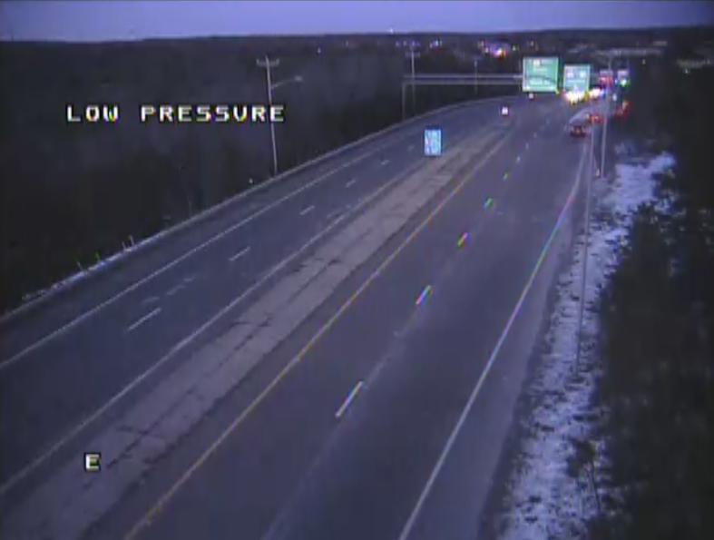
Live camera along your route
Route-Based
Only shows cameras along your specific route
Auto-Refresh
Images update every 30-60 seconds
Drive Mode
See upcoming cameras as you travel
What We Track
Rain & Snow
Intensity & type
Wind Gusts
Dangerous for trucks
Visibility
Fog & heavy rain
Road Temperature
Black ice risk
Traffic
Real-time delays
Live Cameras
Visual verification
