Dallas, TX → New York, NY

1782 mi · 29h 52m (driving)

🚫

Current Risk

High Risk

Extreme Heat Warning in effect — consider delaying

Recommended departure

Saturday

Based on weather forecast

Add traffic to your estimate
🌤️

Dallas

100°

☀️

34.8°

95°

🌤️

36.7°

89°

☀️

38.7°

71°

🌤️

New York

84°

GOING
Sun, Aug 16

Trip Briefing

4 segments · 1782 mi · 29h 52m

Weather

☀️ Clear sky

95°F, wind 5 mph

Incidents

3

1 critical

Rest Stops

40

Truck svc, Restrooms, water

Rest stops in this segment:

  • SoPac Trail Rest Area 🚻
  • QuikTrip 🚻
  • TA

+ 1 more alert

Hazards Ahead

1 road closure may affect your route · 14 construction zones on route

🚧

14 Construction Zones on Route

IH0035E N

Construction on IH0035E

IH0030 EW

Construction on IH0030

IH0030 E

Construction on IH0030

IH0030 E

Construction on IH0030

IH0030 EW

Construction on IH0030

US-0080 E

Construction on US0080

+ 8 more zones along the route — see map for full list

Loading map...

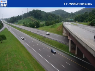
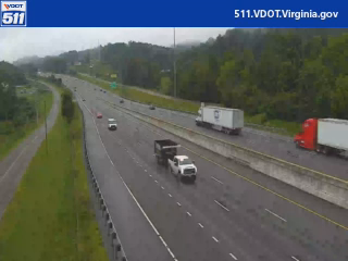
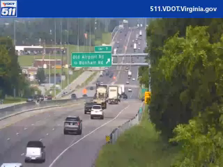
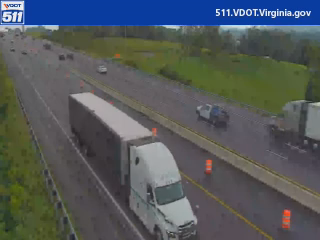
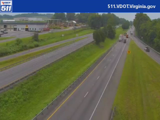
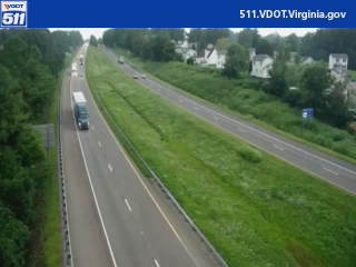
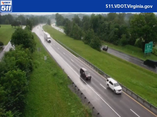
Traffic Cameras

See recent road conditions along your route

Images are snapshots updated periodically by state DOTs. Timestamps shown in images indicate when each photo was captured.

View all cameras

Choose your route:

Selected Route

Via I-30 East → I-440 East → ... → I-81 → I-78 East

I-30 EastI-440 EastI-40I-55 SouthUS-78 +5 more

Cameras shown are along this computed route

Need a custom route?
I-81
12 cameras
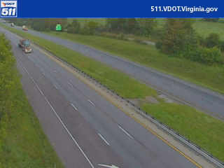
I-81 / MM 72.4 / NB (Tennessee DMS)
1

I-81 / MM 72.4 / NB (Tennessee DMS)

Salem, VA ·

VDOT 511
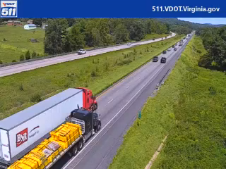
I-81 / MM 1.0 / NB
2

I-81 / MM 1.0 / NB

Salem, VA ·

VDOT 511
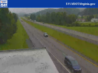
I-81 / MM 5.0 / NB
3

I-81 / MM 5.0 / NB

Salem, VA ·

VDOT 511
I-81 / MM 6.9 / NB
4

I-81 / MM 6.9 / NB

Salem, VA ·

VDOT 511
I-81 / MM 8.6 / NB
5

I-81 / MM 8.6 / NB

Salem, VA ·

VDOT 511
I-81 / MM 13.1 / NB
6

I-81 / MM 13.1 / NB

Salem, VA ·

VDOT 511
I-81 / MM 16.1 / NB
7

I-81 / MM 16.1 / NB

Salem, VA ·

VDOT 511
I-81 / MM 17.7 / NB
8

I-81 / MM 17.7 / NB

Salem, VA ·

VDOT 511
I-81 / MM 29.4 / NB
9

I-81 / MM 29.4 / NB

Salem, VA

VDOT 511
I-81 / MM 90.5 / NB
10

I-81 / MM 90.5 / NB

Salem, VA ·

VDOT 511
I-81 / MM 215 / NB
11

I-81 / MM 215 / NB

Staunton, VA ·

VDOT 511
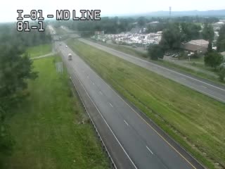
I-81 @ EXIT 1 (MARYLAND LINE)
12

I-81 @ EXIT 1 (MARYLAND LINE)

PA · NB

Rest Stops Along Your Route

185 stops available

Swipe to see more

SoPac Trail Rest Area

Near start

Open
Restrooms

QuikTrip

962 • Near start

Open
Restrooms
Fuel
Food

TA

0049 • Near start

Open
Restrooms
Fuel
Food

Love's Travel Stop

Near start

Open
Restrooms
Fuel
Food

Buc-ee's

Near start

Open
Restrooms
Fuel
Food

Pilot Travel Center

Near start

Open
Restrooms
Fuel
Food

QuikTrip

983 • Near start

Open
Restrooms
Fuel
Food

Hopkins County Eastbound Rest Area

EB • Near start

Open
Restrooms
Picnic

Love's Travel Stop

Near start

Open
Restrooms
Fuel
Food

Pilot Travel Center

Near start

Open
Restrooms
Fuel
Food

Love's Travel Stop

7% along route

Open
Restrooms
Fuel
Food

Rest Area

7% along route

Open
Restrooms
Fuel
Food

Love's Travel Stop

10% along route

Open
Restrooms
Fuel
Food

Road Ranger

10% along route

Open
Restrooms
Fuel
Food

Rest Area

10% along route

Open
Restrooms
Fuel
Food

Rest Area

10% along route

Open
Restrooms
Fuel
Food

Love's Travel Stop

473 • 11% along route

Open
Restrooms
Fuel
Food

Rest Area

11% along route

Open
Restrooms
Fuel
Food

Texas Travel Information Center at Texarkana

11% along route

Open
Restrooms
Picnic
WiFi

Flying J Travel Center

12% along route

Open
Restrooms
Fuel
Food

Flying J Travel Center

12% along route

Open
Restrooms
Fuel
Food

TA

0224 • 14% along route

Open
Restrooms
Fuel
Food

Love's Travel Stop

14% along route

Open
Restrooms
Fuel
Food

Love's Travel Stop

277 • 14% along route

Open
Restrooms
Fuel
Food

Gurdon Rest Area - Eastbound

EB • 15% along route

Open
Restrooms

Pilot Travel Center

16% along route

Open
Restrooms
Fuel
Food

Love's Travel Stop

17% along route

Open
Restrooms
Fuel
Food

JJ's Truck Stop

18% along route

Open
Restrooms
Fuel
Food

Pilot Travel Center

19% along route

Open
Restrooms
Fuel
Food

Love's Travel Stop

457 • 19% along route

Open
Restrooms
Fuel
Food

QuikTrip

7211 • 19% along route

Open
Restrooms
Fuel
Food

Petro Stopping Centers

0326 • 21% along route

Open
Restrooms
Fuel
Food

Pilot Travel Center

21% along route

Open
Restrooms
Fuel
Food

Love's Travel Stop

236 • 21% along route

Open
Restrooms
Fuel
Food

I 40 Truck Rest Area Eastbound

EB • 21% along route

Open
Restrooms

Rest Area

22% along route

Open
Restrooms

Love's Travel Stop

23% along route

Open
Restrooms
Fuel
Food

White River Rest Area - Eastbound

EB • 23% along route

Open
Restrooms

ONE9 Travel Center

24% along route

Open
Restrooms
Fuel
Food

Road Ranger

24% along route

Open
Restrooms
Fuel
Food

Love's Travel Stop

275 • 26% along route

Open
Restrooms
Fuel
Food

Forrest City Rest Area - Eastbound

EB • 26% along route

Open
Restrooms

TA

0033 • 27% along route

Open
Restrooms
Fuel
Food

QwikTrip

29% along route

Open
Restrooms

QuikTrip

7151 • 29% along route

Open
Restrooms
Fuel
Food

Flying J Travel Center

29% along route

Open
Restrooms
Fuel
Food

Love's Travel Stop

29% along route

Open
Restrooms
Fuel
Food

Pilot Travel Center

29% along route

Open
Restrooms
Fuel
Food

Petro Stopping Centers

0311 • 29% along route

Open
Restrooms
Fuel
Food

Rest Area

29% along route

Open
Restrooms

Rest Area

29% along route

Open
Restrooms

Pilot Travel Center

32% along route

Open
Restrooms
Fuel
Food

Rest Area

32% along route

Open
Restrooms

TA

0245 • 33% along route

Open
Restrooms
Fuel
Food

Rest Area

34% along route

Open
Restrooms

Rest Area

35% along route

Open
Restrooms
Fuel
Food

Pilot Travel Center

35% along route

Open
Restrooms
Fuel
Food

Love's Travel Stop

244 • 35% along route

Open
Restrooms
Fuel
Food

Love's Travel Stop

37% along route

Open
Restrooms
Fuel
Food

ONE9 Travel Center

37% along route

Open
Restrooms
Fuel
Food

Rest Area

38% along route

Open
Restrooms

Rest Area

38% along route

Open
Restrooms

Rest Area

39% along route

Open
Restrooms
Fuel
Food

Pilot Travel Center

39% along route

Open
Restrooms
Fuel
Food

Love's Travel Stop

369 • 40% along route

Open
Restrooms
Fuel
Food

Rest Area

40% along route

Open
Restrooms

Rest Area

40% along route

Open
Restrooms

Pilot Travel Center

40% along route

Open
Restrooms
Fuel
Food

QuikTrip

7147 • 40% along route

Open
Restrooms
Fuel
Food

Flying J Travel Center

41% along route

Open
Restrooms
Fuel
Food

Rest Area

41% along route

Open
Restrooms
Fuel
Food

Petro Stopping Centers

0349 • 41% along route

Open
Restrooms
Fuel
Food

Rest Area

42% along route

Open
Restrooms
Fuel
Food

Love's Travel Stop

44% along route

Open
Restrooms
Fuel
Food

Rest Area

44% along route

Open
Restrooms
Fuel
Food

Pilot Travel Center

45% along route

Open
Restrooms
Fuel
Food

Rest Area

45% along route

Open
Restrooms
Fuel
Food

QuikTrip

7145 • 45% along route

Open
Restrooms
Fuel
Food

Pilot Travel Center

46% along route

Open
Restrooms
Fuel
Food

Pilot Travel Center

46% along route

Open
Restrooms
Fuel
Food

Tennessee Visitor Center

47% along route

Open
Restrooms

Love's Travel Stop

330 • 47% along route

Open
Restrooms
Fuel
Food

Buc-ee's

50 • 50% along route

Open
Restrooms
Fuel
Food

Pilot Travel Center

50% along route

Open
Restrooms
Fuel
Food

Eco Travel Plaza

50% along route

Open
Restrooms

Cumberland County I-40 East Rest Area

50% along route

Open
Restrooms

Cumberland County I-40 West Rest Area

50% along route

Open
Restrooms
Picnic

Rest Area

52% along route

Open
Restrooms

Love's Travel Stop

53% along route

Open
Restrooms
Fuel
Food

Flying J Travel Center

53% along route

Open
Restrooms
Fuel
Food

TA

53% along route

Open
Restrooms
Fuel
Food

Pilot Travel Center

53% along route

Open
Restrooms
Fuel
Food

Rest Area

54% along route

Open
Restrooms

Pilot Travel Center

55% along route

Open
Restrooms
Fuel
Food

ONE9 Travel Center

56% along route

Open
Restrooms
Fuel
Food

Jefferson County I-40 East Rest Area

56% along route

Open
Restrooms

I-81 Jefferson County West

57% along route

Open
Restrooms

Pilot Travel Center

57% along route

Open
Restrooms
Fuel
Food

Pilot Travel Center

57% along route

Open
Restrooms
Fuel
Food

Hamblen Farmers' Co-op

57% along route

Open
Restrooms

Love's Travel Stop

58% along route

Open
Restrooms
Fuel
Food

TA

0201 • 59% along route

Open
Restrooms
Fuel
Food

Pilot Travel Center

59% along route

Open
Restrooms
Fuel
Food

I-81 Rest Area - Greene County East

59% along route

Open
Restrooms

I-81 Rest Area - Greene County West

59% along route

Open
Restrooms

Rest Area

60% along route

Open
Restrooms
Info

Tennessee Welcome Center

61% along route

Open
Restrooms

Virginia Welcome Center

61% along route

Open
Restrooms

Love's Travel Stop

63% along route

Open
Restrooms
Fuel
Food

Petro Stopping Centers

0372 • 63% along route

Open
Restrooms
Fuel
Food

Rest Area

65% along route

Open
Restrooms

Rest Area

65% along route

Open
Restrooms

Rest Area

66% along route

Open
Restrooms
Picnic

TA

0143 • 66% along route

Open
Restrooms
Fuel
Food

Rest Area

67% along route

Open
Restrooms
Fuel
Food

Flying J Travel Center

67% along route

Open
Restrooms
Fuel
Food

Pilot Travel Center

67% along route

Open
Restrooms
Fuel
Food

Flying J Travel Center

750 • 67% along route

Open
Restrooms
Fuel
Food

Love's Travel Stop

67% along route

Open
Restrooms
Fuel
Food

Rest Area

69% along route

Open
Restrooms

Radford Safety Rest Area North

69% along route

Open
Restrooms
Picnic

Rest Area

69% along route

Open
Restrooms

Radford Safety Rest Area South

69% along route

Open
Restrooms
Picnic

Radford Travel Center

69% along route

Open
Restrooms
Fuel
Food

Lancer Truck Stop

70% along route

Open
Restrooms
Fuel
Food

Iranto Rest Area

70% along route

Open
Restrooms

ONE9 Travel Center

71% along route

Open
Restrooms
Fuel
Food

Troutville Safety Rest Area

72% along route

Open
Restrooms

Virginia Rest Area Mile 158 South (I-81)

72% along route

Open
Restrooms

TA

0428 • 74% along route

Open
Restrooms
Fuel
Food

Fairfield Safety Rest Area

74% along route

Open
Restrooms

Pilot Travel Center

75% along route

Open
Restrooms
Fuel
Food

Petro Stopping Centers

0427 • 75% along route

Open
Restrooms
Fuel
Food

Pilot Travel Center

75% along route

Open
Restrooms
Fuel
Food

Love's Travel Stop

706 • 75% along route

Open
Restrooms
Fuel
Food
WiFi

Mount Sidney Safety Rest Area North

76% along route

Open
Restrooms

Mount Sidney Safety Rest Area South

76% along route

Open
Restrooms

Buc-ee's

77% along route

Open
Restrooms
Fuel
Food

Harrisonburg Travel Center

77% along route

Open
Restrooms
Fuel
Food

Pilot Travel Center

77% along route

Open
Restrooms
Fuel
Food

Rest Area

78% along route

Open
Restrooms

Rest Area

78% along route

Open
Restrooms

Rest Area

79% along route

Open
Restrooms

Rest Area

79% along route

Open
Restrooms
Fuel
Food

Love's Travel Stop

80% along route

Open
Restrooms
Fuel
Food

Pilot Travel Center

80% along route

Open
Restrooms
Fuel
Food

Virginia Welcome Center at Clear Brook

82% along route

Open
Restrooms

Rest Area

82% along route

Open
Restrooms

Flying J Travel Center

752 • 82% along route

Open
Restrooms
Fuel
Food

I-81 Southbound West Virginia Welcome Center

SB • 83% along route

Open
Restrooms
WiFi
Info

Pilot Travel Center

84% along route

Open
Restrooms
Fuel
Food

Pilot Travel Center

84% along route

Open
Restrooms
Fuel
Food

Rest Area

84% along route

Open
Restrooms
Fuel
Food

Love's Travel Stop

84% along route

Open
Restrooms
Fuel
Food

TA

0213 • 84% along route

Open
Restrooms
Fuel
Food

Cumberland Valley Service Plaza

87% along route

Open
Restrooms

Love's Travel Stop

407 • 87% along route

Open
Restrooms
Fuel
Food

Petro Stopping Centers

0336 • 87% along route

Open
Restrooms
Fuel
Food

Flying J Travel Center

87% along route

Open
Restrooms
Fuel
Food

Flying J Travel Center

89% along route

Open
Restrooms
Fuel
Food

TA

0012 • 89% along route

Open
Restrooms
Fuel
Food

ONE9 Travel Center

89% along route

Open
Restrooms
Fuel
Food

Rest Area

89% along route

Open
Restrooms

Rest Area

89% along route

Open
Restrooms

Love's Travel Stop

366 • 90% along route

Open
Restrooms
Fuel
Food

Flying J Travel Center

91% along route

Open
Restrooms
Fuel
Food

Love's Travel Stop

358 • 92% along route

Open
Restrooms
Fuel
Food

Allentown Service Plaza

94% along route

Open
Restrooms

Rest Area

94% along route

Open
Restrooms

Penn-Jersey Truck Stop

Near destination

Open
Restrooms
Fuel
Food

TA

0048 • Near destination

Open
Restrooms
Fuel
Food

Pilot Travel Center

Near destination

Open
Restrooms
Fuel
Food

Rest Area

Near destination

Open
Restrooms

Rest Area

Near destination

Open
Restrooms

Jugtown Mountain Parking Area

Near destination

Open
Restrooms

Pilot Travel Center

Near destination

Open
Restrooms
Fuel
Food

Cushetunk Rest Area

Near destination

Open
Restrooms

Rest Area

Near destination

Open
Restrooms

Whitney Houston Service Area

Near destination

Open
Restrooms

Valley Settlement House

Near destination

Open
Restrooms

Rest Area

Near destination

Open
Restrooms

Rest Area

Near destination

Open
Restrooms

Pilot Travel Center

Near destination

Open
Restrooms
Fuel
Food

BUS STOP

Near destination

Open
Restrooms

Alexander Hamilton Service Area

Near destination

Open
Restrooms
🔔

Get Weather Alerts for This Route

We'll notify you when conditions change before your trip. Never drive into a surprise storm again.

Recent Weather Events on This Route

Premium users received alerts for these conditions:

  • 🌧️
    Aug 14: Rain advisory for afternoon departures
  • ❄️
    Aug 12: Snow expected at higher elevations - consider earlier departure
  • 🌫️
    Aug 9: Dense fog warning for morning travel

Don't miss the next alert →

Driving from Dallas, TX to New York, NY covers 1782 miles in roughly 29h 52m of drive time, crossing state lines. We track 12 live traffic cameras, 185 rest areas, 3 reported incidents and 4 active weather alerts along this corridor so you can plan around them. On a drive this length, weather can change dramatically between stops. Use the segment-by-segment forecast below to time your route.

7-Day Driving Outlook

Sat

Aug 15

🌤️🌤️

102° / 100°

No precip

Safe

Today

Aug 16

🌤️🌧️

105° / 84°

No precip

Caution

Tomorrow

Aug 17

☀️🌧️

107° / 84°

No precip

Risky

Tue

Aug 18

☀️🌦️

105° / 86°

No precip

Safe

Wed

Aug 19

104° / 87°

No precip

Safe

Thu

Aug 20

☁️🌧️

104° / 87°

No precip

Caution

Fri

Aug 21

☁️

107° / 87°

No precip

Safe

🗓️ Weekend Outlook

Saturday

Good to Go

🌤️ Mainly clear at origin, 🌤️ Mainly clear at destination

Sunday

Good to Go

🌤️ Mainly clear at origin, 🌧️ Moderate rain at destination

Plan This Route

Get hour-by-hour weather forecasts, real-time traffic, and find the optimal departure time.

🚗 Live traffic included

See if current slowdowns affect your drive time

Open in Planner

Free • No sign-up required

Current Conditions

Dallas, TX

🌤️

100°F

Wind: 9 mph

New York, NY

🌤️

84°F

Wind: 8 mph

Weather data updated in real-time

Driving from Dallas, TX to New York, NY

The nearly 1,800-mile journey from Dallas to New York City is one of America's most ambitious road trips, and you'll tackle it primarily via Interstate 30 east toward Arkansas, followed by Interstate 40 across Tennessee and North Carolina, before transitioning to Interstate 81 north through Virginia and eventually connecting to Interstate 78 into New Jersey and the final approach to Manhattan. This routing takes you through the heart of the American South and Mid-Atlantic regions, offering a genuinely diverse driving experience that spans multiple states and distinct geographical zones. While the total drive clocks in at just under 30 hours of pure driving time, most travelers wisely break this into a two or three-day journey to maintain safety and actually enjoy the passing landscape.

As you leave Dallas heading east on I-30, you'll notice the relatively flat terrain of Texas gradually give way to the rolling hills and piney woods of East Texas and Arkansas. The landscape continues to evolve as you push into Tennessee on I-40, where the elevation begins to climb noticeably as you approach the Great Smoky Mountains region near the Tennessee-North Carolina border. This mountainous section offers genuinely beautiful scenery, particularly around Asheville, North Carolina, where the Blue Ridge Mountains provide dramatic ridgelines and forest vistas. Once you transition to I-81 through Virginia, you're traveling through the Appalachian region with its characteristic ridges and valleys, before the terrain gradually moderates as you move into the Mid-Atlantic states.

Your drive takes you through or near several notable cities worth considering for overnight stops, including Memphis, Nashville, Knoxville, and Raleigh, each offering convenient services and potential attractions. The transition from rural Appalachian stretches to the increasingly urban and congested corridors around Philadelphia and New Jersey demands your full attention, particularly in the final 200 miles as you approach the New York metropolitan area. Spring and fall represent ideal seasons for this drive, offering comfortable temperatures and excellent visibility, while summer heat can be intense and winter conditions in the mountains may require extra caution.

The 1782-mile drive from Dallas, Texas to New York, New York takes approximately 29h 52m under normal conditions. Weather along this route can vary significantly, especially along coastal regions where fog and marine weather can impact visibility. Route Outlook helps you find the safest time to travel by showing you weather conditions at every point along your route, timed to when you'll actually be there.

Common Weather Hazards on This Route

  • Winter storms and heavy snowfall (November through April)
  • Black ice on mountain passes and bridges
  • Severe thunderstorms and flash flooding (spring and summer)
  • Hurricane and tropical storm impacts (June through November)

Seasonal Driving Considerations

Coastal weather on this route can shift quickly. Marine fog is common during morning hours, especially in spring and fall, reducing visibility to near zero. Hurricane season (June through November) can bring extended road closures and dangerous conditions. During fair weather, coastal routes offer scenic driving — but always verify conditions with live traffic cameras before heading out.

Best Time to Drive Dallas to New York

For long drives like this 1782-mile journey, planning is essential. Consider breaking the trip into segments if weather looks challenging. The best approach is to check conditions for multiple departure times using Route Outlook's optimizer, which considers weather at each point when you'll actually be there.

Driving Strategy

Covering 1782 miles from Dallas to New York is a full-day or multi-day drive that requires advance planning. Break the route into manageable segments, planning fuel and rest stops every 2-3 hours. Weather that looks fine at departure may deteriorate significantly at the midpoint. Consider booking overnight accommodation if the forecast shows deteriorating conditions in the latter half. Route Outlook's segment-level weather data helps you identify exactly where and when conditions will change.

Pro Tip

Use Route Outlook's departure optimizer to find the best time to leave. Our 4D trajectory engine considers weather at each point along your route at the exact time you'll be there — not just at your destination. It also integrates live data from traffic cameras, DOT 511 feeds, and road weather sensors.

Frequently Asked Questions

How long is the drive from Dallas to New York?

The drive is approximately 1782 miles and takes about 29h 52m under normal traffic and weather conditions. Severe weather can add significant time to your trip.

What's the best day to drive this route?

Based on current forecasts, Wednesday, Aug 19 looks ideal. Clear conditions expected along the entire route

Is it safe to drive from Dallas to New York today?

Current conditions show high risk along this route. Conditions look favorable for travel. Always stay alert and adjust speed for changing conditions.

Are there rest areas on the Dallas to New York route?

Yes, there are 185 rest areas along this route. Facilities include restrooms, parking, and in some cases picnic areas and vending machines. Rest stops are spaced throughout the drive, so you'll never be too far from a break.

Can I see live traffic cameras on this route?

Yes, Route Outlook shows 12 live traffic cameras along this route, sourced from state DOT feeds. You can check road visibility, traffic flow, and pavement conditions in real time before and during your drive.

What highways does this route use?

This route primarily uses I-81. Conditions can vary between highway segments, so check live camera feeds and road condition reports for each stretch before departing.

Are there any road closures on this route right now?

There are currently 3 active incidents along this route that may affect your drive. Check the incident details above for specific locations and expected durations.

Don't Drive Blind Into Weather

Route Outlook shows you conditions at every point along your route—at the exact time you'll be there.

Open Planner