Indianapolis, IN → Orlando, FL

1069 mi · 17h 55m (driving)

🚫

Current Risk

High Risk

Flood Watch in effect — consider delaying

Recommended departure

Check hourly forecast

Based on weather forecast

Add traffic to your estimate
☁️

Indianapolis

72°

🌫️

37.0°

73°

☀️

34.2°

74°

🌫️

31.3°

73°

☀️

Orlando

75°

GOING
Sat, Aug 15

Trip Briefing

4 segments · 1069 mi · 17h 55m

Weather

🌫️ Fog

73°F, wind 1 mph

Rest Stops

37

Truck svc, Restrooms, information

Clear driving conditions expected

Rest stops in this segment:

  • Rest Area 🚻
  • Horner Industrial Group 🚻
  • Mr. Fuel Travel Center

+ 2 more alerts

Weather May Slow Traffic

Active weather advisory — expect slower travel

Loading map...

Traffic Cameras

See recent road conditions along your route

Images are snapshots updated periodically by state DOTs. Timestamps shown in images indicate when each photo was captured.

View all cameras

Choose your route:

Selected Route

Via I-70 → I-65 South → ... → Florida's Turnpike → I-4 East

North Meridian StreetI-70I-65 SouthI-24 EastI-40 +5 more

Cameras shown are along this computed route

Need a custom route?

Other
12 cameras
GDOT-1527: CCTV Trailer Camera 0310637
1

GDOT-1527: CCTV Trailer Camera 0310637

GA ·
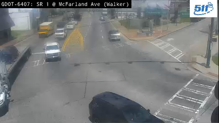
WALK-0050: SR 1 at Mcfarland Ave (Walker)
2

WALK-0050: SR 1 at Mcfarland Ave (Walker)

GA · SB

WALK-0017: SR 1 at Clark St (Walker)
3

WALK-0017: SR 1 at Clark St (Walker)

GA · EB
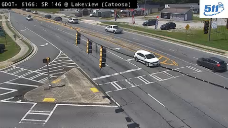
CATO-0011: SR 146 at Lakeview Rd (Catoosa)
4

CATO-0011: SR 146 at Lakeview Rd (Catoosa)

GA · EB
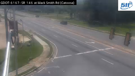
CATO-0004: SR 146 at Mack Smith Rd (Catoosa)
5

CATO-0004: SR 146 at Mack Smith Rd (Catoosa)

GA · EB

GDOT-1376: I-75 S at SR146 MM 353.3 (Catoosa)
6

GDOT-1376: I-75 S at SR146 MM 353.3 (Catoosa)

GA · SB

GDOT-1204: I-75 S at US411 MM 293.2 (Bartow)
7

GDOT-1204: I-75 S at US411 MM 293.2 (Bartow)

GA · SB

GDOT-1192: I-75 S at SR16 MM 205.2 (Butts)
8

GDOT-1192: I-75 S at SR16 MM 205.2 (Butts)

GA · SB

DOOL-0001: SR 215 at I-75 NB  (Dooly)
9

DOOL-0001: SR 215 at I-75 NB (Dooly)

GA · EB
GDOT-1172: I-75 S before WMitchellSt MM 40.5 (Cook)
10

GDOT-1172: I-75 S before WMitchellSt MM 40.5 (Cook)

GA · SB
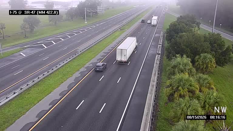
I-75 @ MM 422.8 / SR-47
11

I-75 @ MM 422.8 / SR-47

FL · SB

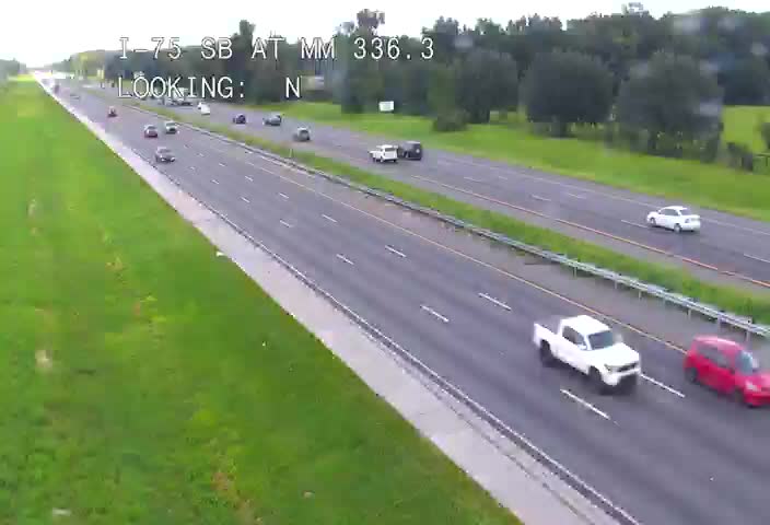
I-75 @ MM 336.3 SB
12

I-75 @ MM 336.3 SB

FL · SB

Rest Stops Along Your Route

162 stops available

Swipe to see more

Rest Area

Near start

Open
Restrooms

Horner Industrial Group

Near start

Open
Restrooms

Mr. Fuel Travel Center

Near start

Open
Restrooms
Fuel
Food

Pilot Travel Center

Near start

Open
Restrooms
Fuel
Food

Flying J Travel Center

Near start

Open
Restrooms
Fuel
Food

Speedco Indianapolis

Near start

Open
Restrooms

Road Ranger

Near start

Open
Restrooms
Fuel
Food

Pilot Travel Center

37 • Near start

Open
Restrooms
Fuel
Food

Love's Travel Stop

451 • Near start

Open
Restrooms
Fuel
Food

Flying J Travel Center

Near start

Open
Restrooms
Fuel
Food

Rest Area

Near start

Open
Restrooms

Rest Area

Near start

Open
Restrooms
Info

TA

0065 • 6% along route

Open
Restrooms
Fuel
Food

Rest Area

9% along route

Open
Restrooms

Rest Area

9% along route

Open
Restrooms

Rest Area

9% along route

Open
Restrooms

Pilot Travel Center

10% along route

Open
Restrooms
Fuel
Food

Rest Area

12% along route

Open
Restrooms
Fuel
Food

Pilot Travel Center

13% along route

Open
Restrooms
Fuel
Food

Love's Travel Stop

238 • 13% along route

Open
Restrooms
Fuel
Food

Rest Area

13% along route

Open
Restrooms
Fuel
Food

Bullitt County Welcome Center

14% along route

Open
Restrooms

Pilot Travel Center

14% along route

Open
Restrooms
Fuel
Food

Rest Area

16% along route

Open
Restrooms
Fuel
Food

Love's Travel Stop

716 • 16% along route

Open
Restrooms
Fuel
Food

Petro Stopping Centers

0330 • 16% along route

Open
Restrooms
Fuel
Food

Pilot Travel Center

16% along route

Open
Restrooms
Fuel
Food

ONE9 Travel Center

17% along route

Open
Restrooms
Fuel
Food

Hart County (Horse County) Northbound Rest Area

NB • 19% along route

Open
Restrooms

Hart County (Horse County) Southbound Rest Area

SB • 19% along route

Open
Restrooms

Love's Travel Stop

19% along route

Open
Restrooms
Fuel
Food

Rest Area

21% along route

Open
Restrooms
Fuel
Food

TA

0468 • 21% along route

Open
Restrooms
Fuel
Food

Buc-ee's

21% along route

Open
Restrooms
Fuel
Food

Rest Area

25% along route

Open
Restrooms

Pilot Travel Center

25% along route

Open
Restrooms
Fuel
Food

ONE9 Travel Center

25% along route

Open
Restrooms
Fuel
Food

Flying J Travel Center

25% along route

Open
Restrooms
Fuel
Food

Franklin Welcome Center

25% along route

Open
Restrooms

Robertson County Welcome Center

25% along route

Open
Restrooms

Rest Area

25% along route

Open
Restrooms
Fuel
Food

Love's Travel Stop

27% along route

Open
Restrooms
Fuel
Food

QuikTrip

7144 • 28% along route

Open
Restrooms
Fuel
Food

Love's Travel Stop

29% along route

Open
Restrooms
Fuel
Food

Bay 10

29% along route

Open
Restrooms

Bay 8

29% along route

Open
Restrooms

Bay 9

29% along route

Open
Restrooms

Bay 7

29% along route

Open
Restrooms

Bay 6

29% along route

Open
Restrooms

Bay 1

29% along route

Open
Restrooms

Bay 5

29% along route

Open
Restrooms

Bay 2

29% along route

Open
Restrooms

Bay 4

29% along route

Open
Restrooms

Bay 3

29% along route

Open
Restrooms

TA

0117 • 30% along route

Open
Restrooms
Fuel
Food

Pilot Travel Center

31% along route

Open
Restrooms
Fuel
Food

Rest Area

31% along route

Open
Restrooms
Fuel
Food

Rest Area

31% along route

Open
Restrooms
Fuel
Food

The Bug Man

32% along route

Open
Restrooms

Buc-ee's

33% along route

Open
Restrooms
Fuel
Food

Love's Travel Stop

33% along route

Open
Restrooms
Fuel
Food

I-24 Truck Plaza

36% along route

Open
Restrooms
Fuel
Food

Love's Travel Stop

36% along route

Open
Restrooms
Fuel
Food

Grundy Count Rest Area - West Bound

38% along route

Open
Restrooms
Fuel
Food

Grundy Count Rest Area - East Bound

38% along route

Open
Restrooms
Fuel
Food

Rest Area

38% along route

Open
Restrooms

Pilot Travel Center

38% along route

Open
Restrooms
Fuel
Food

Love's Travel Stop

41% along route

Open
Restrooms
Fuel
Food

Rest Area

41% along route

Open
Restrooms

Tennessee Welcome Center

41% along route

Open
Restrooms

Rest Area

41% along route

Open
Restrooms

ONE9 Travel Center

42% along route

Open
Restrooms
Fuel
Food

Rest Area

42% along route

Open
Restrooms

Tennessee Welcome Center

43% along route

Open
Restrooms

Georgia Visitor Information Center - I 75 South

44% along route

Open
Restrooms

Rest Area

45% along route

Open
Restrooms
Fuel
Food

Rest Area

45% along route

Open
Restrooms
Fuel
Food

ONE9 Travel Center

46% along route

Open
Restrooms
Fuel
Food

Pilot Travel Center

46% along route

Open
Restrooms
Fuel
Food

Flying J Travel Center

47% along route

Open
Restrooms
Fuel
Food

Rest Area

47% along route

Open
Restrooms

Pilot Travel Center

47% along route

Open
Restrooms
Fuel
Food

Love's Travel Stop

48% along route

Open
Restrooms
Fuel
Food
WiFi

Buc-ee's

48% along route

Open
Restrooms
Fuel
Food

I-75 Rest Area

48% along route

Open
Restrooms

QuikTrip

757 • 48% along route

Open
Restrooms
Fuel
Food

Rest Area

48% along route

Open
Restrooms
Fuel
Food

TA

0146 • 49% along route

Open
Restrooms
Fuel
Food

Pilot Travel Center

49% along route

Open
Restrooms
Fuel
Food

Rest Area

50% along route

Open
Restrooms
Fuel
Food

Love's Travel Stop

51% along route

Open
Restrooms
Fuel
Food

Petro Stopping Centers

0322 • 54% along route

Open
Restrooms
Fuel
Food
WiFi

Pilot Travel Center

55% along route

Open
Restrooms
Fuel
Food

RaceTrac

55% along route

Open
Restrooms
Fuel
Food

Rest Area

56% along route

Open
Restrooms
Fuel
Food

QuikTrip

787 • 56% along route

Open
Restrooms
Fuel
Food

JP Travel Center

59% along route

Open
Restrooms
Fuel
Food

Flying J Travel Center

59% along route

Open
Restrooms
Fuel
Food

Love's Travel Stop

307 • 59% along route

Open
Restrooms
Fuel
Food

Pilot Travel Center

59% along route

Open
Restrooms
Fuel
Food

TA

0268 • 59% along route

Open
Restrooms
Fuel
Food

Monroe County Weigh Station - I-75 Northbound

NB • 60% along route

Open
Restrooms
Fuel
Food

Monroe County Weigh Station - I-75 Southbound

SB • 60% along route

Open
Restrooms
Fuel
Food

QuikTrip

1730 • 61% along route

Open
Restrooms
Fuel
Food

Rest Area

SB • 61% along route

Open
Basic facilities

19 Rest Area

19 • 62% along route

Open
Restrooms
Picnic

Circle K

63% along route

Open
Restrooms
Fuel
Food

Love's Travel Stop

698 • 63% along route

Open
Restrooms
Fuel
Food

QuikTrip

1722 • 63% along route

Open
Restrooms
Fuel
Food

Pilot Travel Center

64% along route

Open
Restrooms
Fuel
Food

Buc-ee's

64% along route

Open
Restrooms
Fuel
Food

All State Truck Stop

67% along route

Open
Restrooms
Fuel
Food

Rest Area

67% along route

Open
Basic facilities

Pinehurst Gas 'N Go Travel Center & Truck Wash

67% along route

Open
Restrooms
Fuel
Food

ONE9 Travel Center

68% along route

Open
Restrooms
Fuel
Food

Rest Area

68% along route

Open
Restrooms

Love's Travel Stop

69% along route

Open
Restrooms
Fuel
Food
WiFi

Pilot Travel Center

69% along route

Open
Restrooms
Fuel
Food

Rest Area

NB • 70% along route

Open
Restrooms

Rest Area

71% along route

Open
Restrooms

Pilot Travel Center

73% along route

Open
Restrooms
Fuel
Food
WiFi

Love's Travel Stop

73% along route

Open
Restrooms
Fuel
Food
WiFi

Rest Area

SB • 74% along route

Open
Restrooms
Mar 27-Aug 24 closed; Aug 25-Dec 31 open; Jan 01-Mar 26 open Directions

Rest Area

NB • 74% along route

Open
Restrooms
Mar 27-Aug 24 closed; Aug 25-Dec 31 open; Jan 01-Mar 26 open Directions

Adel Truck Plaza

75% along route

Open
Restrooms
Fuel
Food

I-75 Southbound Weigh Station

SB • 77% along route

Open
Restrooms
Fuel
Food

QuikTrip

7071 • 77% along route

Open
Restrooms
Fuel
Food

Rest Area

77% along route

Open
Restrooms
Fuel
Food

Bigfoot Traffic Center

77% along route

Open
Restrooms

Love's Travel Stop

550 • 78% along route

Open
Restrooms
Fuel
Food
WiFi

Love's Travel Stop

550 • 78% along route

Open
Restrooms
Fuel
Food
WiFi

Pilot Travel Center

78% along route

Open
Restrooms
Fuel
Food
WiFi

Georgia Visitor Information Center

79% along route

Open
Restrooms

TA

0249 • 79% along route

Open
Restrooms
Fuel
Food

Flying J Travel Center

79% along route

Open
Restrooms
Fuel
Food
WiFi

Joseph O. Striska Official Florida Welcome Center

20140 • 79% along route

Open
Restrooms

Pilot Travel Center

80% along route

Open
Restrooms
Fuel
Food

Pilot Travel Center

80% along route

Open
Restrooms
Fuel
Food

Love's Travel Stop

81% along route

Open
Restrooms
Fuel
Food

Busy Bee Truck Stop

82% along route

Open
Restrooms
Fuel
Food

Suwannee County Rest Area Eastbound

20111 • EB • 83% along route

Open
Restrooms

Columbia County Rest Area Westbound

20112 • WB • 83% along route

Open
Restrooms

Love's Travel Stop

85% along route

Open
Restrooms
Fuel
Food

TA

0288 • 85% along route

Open
Restrooms
Fuel
Food

Columbia County Rest Area (I-75 southbound)

20162 • SB • 85% along route

Open
Restrooms

Alachua County Rest Area (I-75 southbound)

20172 • SB • 89% along route

Open
Restrooms

Alachua County Rest Area (I-75 northbound)

20171 • NB • 89% along route

Open
Restrooms

Petro Stopping Centers

0323 • 90% along route

Open
Restrooms
Fuel
Food

Love's Travel Stop

363 • 91% along route

Open
Restrooms
Fuel
Food

Pilot Travel Center

91% along route

Open
Restrooms
Fuel
Food

Pilot Travel Center

424 • 91% along route

Open
Restrooms
Fuel
Food

Marion County Rest Area Southbound

50182 • SB • 92% along route

Open
Restrooms

Pilot Travel Center

93% along route

Open
Restrooms
Fuel
Food

Rest Area

93% along route

Open
Restrooms

Wildwood I-75 Weigh Station Southbound

50662 • SB • 93% along route

Open
Restrooms

TA

0053 • 94% along route

Open
Restrooms
Fuel
Food

Pilot Travel Center

94% along route

Open
Restrooms
Fuel
Food

Pilot Travel Center

4556 • 94% along route

Open
Restrooms
Fuel
Food

Okahumpka Service Plaza

Near destination

Open
Restrooms

Turkey Lake Service Plaza

Near destination

Open
Restrooms

Rest Area

Near destination

Open
Restrooms

Option Cargo Express

Near destination

Open
Restrooms
🔔

Get Weather Alerts for This Route

We'll notify you when conditions change before your trip. Never drive into a surprise storm again.

Recent Weather Events on This Route

Premium users received alerts for these conditions:

  • 🌫️
    Aug 10: Dense fog warning for morning departures - visibility below 1/4 mile

Don't miss the next alert →

Driving from Indianapolis, IN to Orlando, FL covers 1069 miles in roughly 17h 55m of drive time, crossing state lines. We track 12 live traffic cameras, 162 rest areas and 5 active weather alerts along this corridor so you can plan around them. On a drive this length, weather can change dramatically between stops. Use the segment-by-segment forecast below to time your route.

7-Day Driving Outlook

Today

Aug 15

🌧️☁️

86° / 70°

45% precip

Caution

Tomorrow

Aug 16

🌧️☁️

84° / 71°

47% precip

Caution

Mon

Aug 17

☁️🌧️

80° / 67°

24% precip

Safe

Tue

Aug 18

☁️🌧️

83° / 61°

1% precip

Safe

Wed

Aug 19

🌧️⛈️

78° / 68°

31% precip

Avoid

Thu

Aug 20

☁️⛈️

76° / 64°

31% precip

Avoid

Fri

Aug 21

☁️☁️

77° / 64°

9% precip

Safe

🗓️ Weekend Outlook

Saturday

Good to Go

🌧️ Moderate rain at origin, ☁️ Overcast at destination

Sunday

Good to Go

🌧️ Moderate drizzle at origin, ☁️ Overcast at destination

Plan This Route

Get hour-by-hour weather forecasts, real-time traffic, and find the optimal departure time.

🚗 Live traffic included

See if current slowdowns affect your drive time

Open in Planner

Free • No sign-up required

Current Conditions

Indianapolis, IN

☁️

72°F

Wind: 3 mph

Orlando, FL

☀️

75°F

Wind: 2 mph

Weather data updated in real-time

Driving from Indianapolis, IN to Orlando, FL

Your route from Indianapolis to Orlando spans nearly 1,070 miles through some of America's most varied landscapes, primarily following I-75 south through Kentucky, Tennessee, Georgia, and into Florida. You'll begin by heading south on I-75 from Indianapolis, passing through the rolling Bluegrass region of Kentucky before the interstate takes you into the Cumberland Plateau area of Tennessee. The drive becomes noticeably more mountainous as you navigate through Knoxville and approach the Great Smoky Mountains to your east, with elevation gradually climbing before descending again as you transition into Georgia. This central corridor is the most direct route and the one preferred by most long-distance travelers making this journey.

As you cross into Georgia near Chattanooga, the Appalachian terrain gives way to the gentler, more rolling topography of the Deep South, and the landscape gradually flattens considerably. You'll pass through Atlanta, one of the major urban centers on this route, where you should expect heavier traffic and plan accordingly—this is a necessary but potentially time-consuming segment. Below Atlanta, the terrain continues to flatten dramatically as you head toward Macon and into Florida, where you'll notice the landscape becoming increasingly subtropical with pine forests and marshlands characteristic of the Southeast.

The final stretch into Florida sees I-75 become more monotonous but also more predictable, with fewer elevation changes and longer stretches of relatively straight highway through central Florida. You'll pass through Ocala before eventually reaching the Orlando metropolitan area, where urban sprawl and increased traffic will signal your arrival. This entire drive takes roughly 18 hours of actual driving time, making it ideal for breaking into two days with an overnight stop in Georgia or northern Florida.

The best times to attempt this drive are late fall through early spring, when temperatures remain moderate throughout the South and you'll avoid the intense summer heat and afternoon thunderstorms that plague Florida from June through September. Winter driving through Tennessee can occasionally present challenges with ice on elevated sections, so check conditions before departing during those months.

The 1069-mile drive from Indianapolis, Indiana to Orlando, Florida takes approximately 17h 55m under normal conditions. Weather along this route can vary significantly, especially across open plains where severe weather and high winds can develop quickly. Route Outlook helps you find the safest time to travel by showing you weather conditions at every point along your route, timed to when you'll actually be there.

Common Weather Hazards on This Route

  • Dense fog, especially during early morning hours
  • Severe thunderstorms and flash flooding (spring and summer)
  • Hurricane and tropical storm impacts (June through November)

Seasonal Driving Considerations

The Midwest corridor of this route is susceptible to rapid weather changes. Severe thunderstorms and tornadoes are a real threat from April through June, while winter brings heavy lake-effect snow, ice storms, and dangerously low wind chill. Flat terrain means high crosswinds can affect vehicle stability year-round, especially for taller vehicles. Spring flooding can also close highway underpasses and low-lying road segments.

Best Time to Drive Indianapolis to Orlando

For long drives like this 1069-mile journey, planning is essential. Consider breaking the trip into segments if weather looks challenging. The best approach is to check conditions for multiple departure times using Route Outlook's optimizer, which considers weather at each point when you'll actually be there.

Driving Strategy

Covering 1069 miles from Indianapolis to Orlando is a full-day or multi-day drive that requires advance planning. Break the route into manageable segments, planning fuel and rest stops every 2-3 hours. Weather that looks fine at departure may deteriorate significantly at the midpoint. Consider booking overnight accommodation if the forecast shows deteriorating conditions in the latter half. Route Outlook's segment-level weather data helps you identify exactly where and when conditions will change.

Pro Tip

Use Route Outlook's departure optimizer to find the best time to leave. Our 4D trajectory engine considers weather at each point along your route at the exact time you'll be there — not just at your destination. It also integrates live data from traffic cameras, DOT 511 feeds, and road weather sensors.

Frequently Asked Questions

How long is the drive from Indianapolis to Orlando?

The drive is approximately 1069 miles and takes about 17h 55m under normal traffic and weather conditions. Severe weather can add significant time to your trip.

What's the best day to drive this route?

Based on current forecasts, Tuesday, Aug 18 looks ideal. Calm winds and the best conditions this week

Is it safe to drive from Indianapolis to Orlando today?

Current conditions show high risk along this route. Use caution and allow extra time. Reduce speed and increase following distance as conditions warrant.

Are there rest areas on the Indianapolis to Orlando route?

Yes, there are 162 rest areas along this route. Facilities include restrooms, parking, and in some cases picnic areas and vending machines. Rest stops are spaced throughout the drive, so you'll never be too far from a break.

Can I see live traffic cameras on this route?

Yes, Route Outlook shows 12 live traffic cameras along this route, sourced from state DOT feeds. You can check road visibility, traffic flow, and pavement conditions in real time before and during your drive.

What highways does this route use?

This route primarily uses Other. Conditions can vary between highway segments, so check live camera feeds and road condition reports for each stretch before departing.

Are there any road closures on this route right now?

No significant incidents or road closures are currently reported along this route. Conditions can change quickly — this page updates automatically with the latest data from state DOT 511 systems.

Don't Drive Blind Into Weather

Route Outlook shows you conditions at every point along your route—at the exact time you'll be there.

Open Planner