Minneapolis, MN → New York, NY

1321 mi · 22h 8m (driving)

Current Risk

Low Risk

Clear conditions along your route

Good to go now

Leave anytime today

Based on weather forecast

Add traffic to your estimate
☁️

Minneapolis

73°

☁️

43.9°

73°

🌧️

42.8°

74°

🌤️

41.8°

71°

☀️

New York

71°

GOING
Thu, Aug 13

Trip Briefing

4 segments · 1321 mi · 22h 9m

Weather

☁️ Overcast

73°F, wind 2 mph

Rest Stops

38

Restrooms, Truck svc

Cameras

6 live

Clear driving conditions expected

Rest stops in this segment:

  • Rest Area 🚻
  • Rest Area 🚻
  • Rest Area

Normal Traffic

No traffic incidents reported

Loading map...

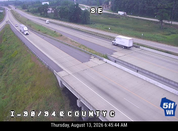
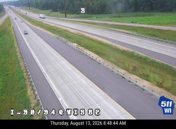
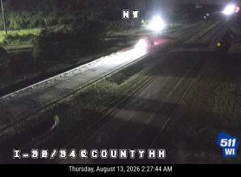
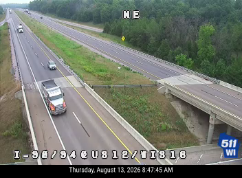
Traffic Cameras

See recent road conditions along your route

Images are snapshots updated periodically by state DOTs. Timestamps shown in images indicate when each photo was captured.

View all cameras

Choose your route:

Selected Route

Via I-94 East → I-39 South → ... → NJ-139 → I-78 East

South 6th StreetI-94 EastI-39 SouthI-90I-90 East +10 more

Cameras shown are along this computed route

Need a custom route?
I-90
12 cameras
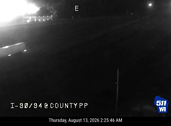
I-90/94  - I-90/94 at County PP
1

I-90/94 - I-90/94 at County PP

WI ·

I-90/94  - I-90/94 at County C
2

I-90/94 - I-90/94 at County C

WI ·

I-90/94  - I-90/94 at WIS 82
3

I-90/94 - I-90/94 at WIS 82

WI ·

I-90/94  - I-90/94 at County HH
4

I-90/94 - I-90/94 at County HH

WI ·

I-90/94  - I-90/94 at US 12/WIS 16
5

I-90/94 - I-90/94 at US 12/WIS 16

WI ·
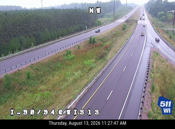
I-90/94  - I-90/94 at WIS 13
6

I-90/94 - I-90/94 at WIS 13

WI ·

Randall Rd at I-90WB
7

Randall Rd at I-90WB

IL ·

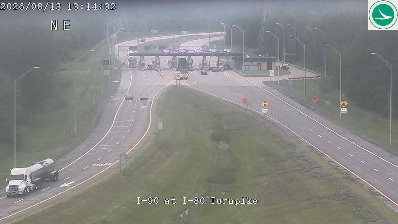
I-90 at I-80 Turnpike
8

I-90 at I-80 Turnpike

OH

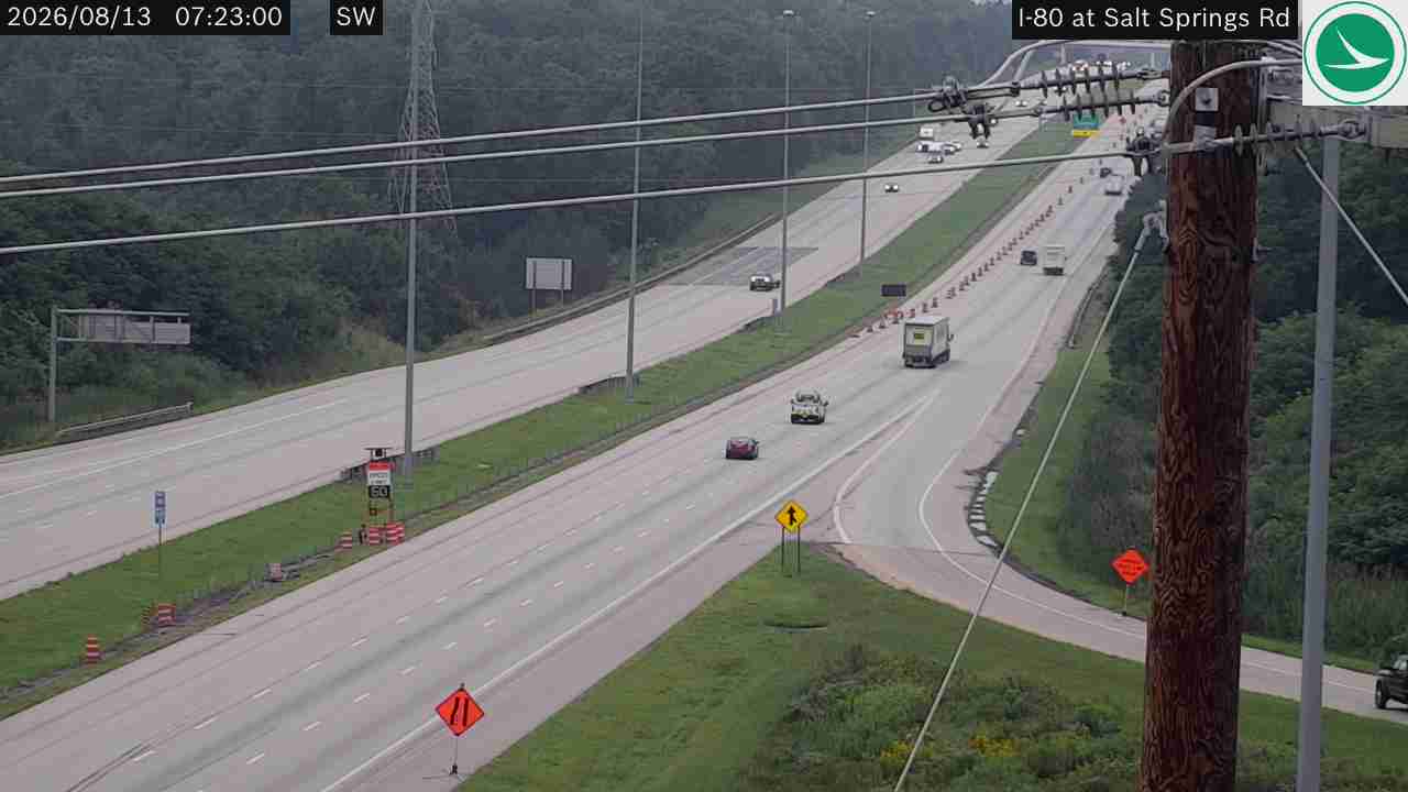
I-80 at Salt Springs Rd
9

I-80 at Salt Springs Rd

OH

I-80 @ EXIT 81 (HAZEN)
10

I-80 @ EXIT 81 (HAZEN)

PA · EB

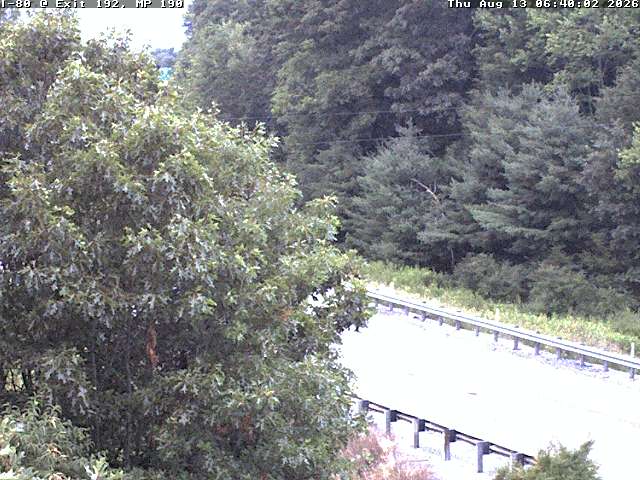
I-80 E/B @ MM 190.6 Clinton Co.
11

I-80 E/B @ MM 190.6 Clinton Co.

PA ·

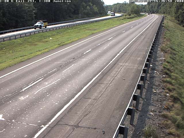
I-80 W/B MM 287.2 @ Stoney Hollow Rd Monroe Co.
12

I-80 W/B MM 287.2 @ Stoney Hollow Rd Monroe Co.

PA ·

Rest Stops Along Your Route

179 stops available

Swipe to see more

Rest Area

Near start

Open
Restrooms

Rest Area

Near start

Open
Restrooms

Rest Area

Near start

Open
Restrooms
Fuel
Food

St. Croix Rest Area

Near start

Open
Restrooms

Saint Croix Weigh Station

Near start

Open
Restrooms

TA

0192 • Near start

Open
Restrooms
Fuel
Food

Flying J Travel Center

Near start

Open
Restrooms
Fuel
Food

Rest Area

Near start

Open
Restrooms
Fuel
Food

Rest Area

6% along route

Open
Restrooms

Rest Area

6% along route

Open
Restrooms

Menomonie Eastbound Rest Area 61

EB • 7% along route

Open
Restrooms

Love's Travel Stop

7% along route

Open
Restrooms
Fuel
Food

Rest Area

7% along route

Open
Restrooms
Fuel
Food

Rest Area

8% along route

Open
Restrooms
Fuel
Food

Rest Area

10% along route

Open
Restrooms

Flying J Travel Center

13% along route

Open
Restrooms
Fuel
Food

Rest Area

13% along route

Open
Restrooms

Black River Falls Rest Area 54

13% along route

Open
Restrooms

Rest Area

13% along route

Open
Restrooms

Millston Rest Area 53

13% along route

Open
Restrooms

Love's Travel Stop

345 • 15% along route

Open
Restrooms
Fuel
Food

Road Ranger

15% along route

Open
Restrooms

Rest Area

17% along route

Open
Restrooms
Fuel
Food

Rest Area

17% along route

Open
Restrooms
Fuel
Food

Pilot Travel Center

17% along route

Open
Restrooms
Fuel
Food

Lyndon Station Rest Area 9

17% along route

Open
Restrooms

Mauston Rest Area 10

18% along route

Open
Restrooms

Rest Area

19% along route

Open
Restrooms

Petro Stopping Centers

0403 • 20% along route

Open
Restrooms
Fuel
Food

Portage Rest Area 11

20% along route

Open
Restrooms

Poynette Rest Area 12

20% along route

Open
Restrooms

Love's Travel Stop

21% along route

Open
Restrooms
Fuel
Food

TA

0050 • 22% along route

Open
Restrooms
Fuel
Food

Pleasant Springs Travel Plaza

23% along route

Open
Restrooms

Road Ranger

23% along route

Open
Restrooms
Fuel
Food

Janesville Rest Area 17

24% along route

Open
Restrooms

Rest Area

24% along route

Open
Restrooms

Petro Stopping Centers

0071 • 25% along route

Open
Restrooms
Fuel
Food

Pilot Travel Center

25% along route

Open
Restrooms
Fuel
Food

Beloit Rest Area 22

26% along route

Open
Restrooms

Road Ranger

26% along route

Open
Restrooms
Fuel
Food

Flying J Travel Center

26% along route

Open
Restrooms
Fuel
Food

Turtle Creek Welcome Center (Southbound Only)

SB • 26% along route

Open
Restrooms
Vending

Speedway

3962 • 26% along route

Open
Restrooms
Fuel
Food

Rest Area

26% along route

Open
Restrooms
Fuel
Food

Love's Travel Stop

26% along route

Open
Restrooms
Fuel
Food

Love's Travel Stop

28% along route

Open
Restrooms
Fuel
Food

Road Ranger

28% along route

Open
Restrooms
Fuel
Food

Speedway

28% along route

Open
Restrooms
Fuel
Food

TA

0044 • 28% along route

Open
Restrooms
Fuel
Food

Pilot Travel Center

31% along route

Open
Restrooms
Fuel
Food

QuikTrip

7195 • 31% along route

Open
Restrooms
Fuel
Food

Pilot Travel Center

31% along route

Open
Restrooms
Fuel
Food

AF Truck Center

31% along route

Open
Restrooms

O'Hare Oasis

31% along route

Open
Restrooms
Vending

QuikTrip

7208 • 32% along route

Open
Restrooms
Fuel
Food

Hinsdale Oasis

32% along route

Open
Restrooms
Vending

Rest Area

32% along route

Open
Restrooms

Rest Area

32% along route

Open
Restrooms

Pilot Travel Center

32% along route

Open
Restrooms
Fuel
Food

Pilot Travel Center

33% along route

Open
Restrooms
Fuel
Food

Rest Area

33% along route

Open
Restrooms

Chicago Southland Lincoln Oasis

34% along route

Open
Restrooms
Vending

Love's Travel Stop

34% along route

Open
Restrooms
Fuel
Food

Pilot Travel Center

34% along route

Open
Restrooms
Fuel
Food

TA

0010 • 35% along route

Open
Restrooms
Fuel
Food

Pilot Travel Center

35% along route

Open
Restrooms
Fuel
Food

Mr. Fuel Travel Center

35% along route

Open
Restrooms
Fuel
Food

Love's Travel Stop

35% along route

Open
Restrooms
Fuel
Food

Rest Area

35% along route

Open
Restrooms
Fuel
Food

Petro Stopping Centers

0369 • 35% along route

Open
Restrooms
Fuel
Food

Rest Area

35% along route

Open
Restrooms
Fuel
Food

Road Ranger

35% along route

Open
Restrooms
Fuel
Food

Mr. Fuel Travel Center

35% along route

Open
Restrooms
Fuel
Food

TA

0219 • 35% along route

Open
Restrooms
Fuel
Food

Flying J Travel Center

35% along route

Open
Restrooms
Fuel
Food

George Ade Travel Plaza

1 • 35% along route

Open
Restrooms
Fuel
Food

J.T. McCutcheon Travel Plaza

1 • 35% along route

Open
Restrooms

Pilot Travel Center

36% along route

Open
Restrooms
Fuel
Food

TA

0220 • 36% along route

Open
Restrooms
Fuel
Food

Rest Area

37% along route

Open
Restrooms

Rest Area

37% along route

Open
Restrooms

Rest Area

37% along route

Open
Restrooms

Love's Travel Stop

37% along route

Open
Restrooms
Fuel
Food

Rest Area

37% along route

Open
Restrooms
Fuel
Food

Knute Rockne Travel Plaza EB

EB • 38% along route

Open
Restrooms

Pilot Travel Center

40% along route

Open
Restrooms
Fuel
Food

Rest Area

40% along route

Open
Restrooms
Fuel
Food

Rest Area

40% along route

Open
Restrooms

George N. Craig Travel Plaza EB

EB • 41% along route

Open
Restrooms

Love's Travel Stop

729 • 42% along route

Open
Restrooms
Fuel
Food

Rest Area

43% along route

Open
Restrooms
Fuel
Food

Ernie Pyle Travel Plaza (Eastbound)

EB • 45% along route

Open
Restrooms
Fuel
Food

Love's Travel Stop

46% along route

Open
Restrooms
Fuel
Food

Pilot Travel Center

46% along route

Open
Restrooms
Fuel
Food

Petro Stopping Centers

0345 • 46% along route

Open
Restrooms
Fuel
Food

Love's Travel Stop

47% along route

Open
Restrooms
Fuel
Food

Indian Meadow

49% along route

Open
Restrooms
Fuel
Food

Tiffin River

49% along route

Open
Restrooms
Fuel
Food

Horse Rest Area

52% along route

Open
Restrooms

Love's Travel Stop

456 • 54% along route

Open
Restrooms
Fuel
Food

Petro Stopping Centers

0317 • 54% along route

Open
Restrooms
Fuel
Food

Rest Area

54% along route

Open
Restrooms
Fuel
Food

Flying J Travel Center

54% along route

Open
Restrooms
Fuel
Food

Pilot Travel Center

54% along route

Open
Restrooms
Fuel
Food

TA

0087 • 54% along route

Open
Restrooms
Fuel
Food

Blue Heron Service Area

54% along route

Open
Restrooms
Fuel
Food

Wyandot Service Area

54% along route

Open
Restrooms
Fuel
Food

Erie Islands Service Plaza

56% along route

Open
Restrooms
Fuel
Food

Commodore Perry Service Plaza

56% along route

Open
Restrooms
Fuel
Food

Rest Area

58% along route

Open
Restrooms

Rest Area

58% along route

Open
Restrooms

Rest Area

58% along route

Open
Restrooms

Rest Area

58% along route

Open
Restrooms

Receiving Area B

58% along route

Open
Restrooms

Rest Area

58% along route

Open
Restrooms

Lorain Rest Area

59% along route

Open
Restrooms

Rest Area

59% along route

Open
Restrooms

Rest Area

59% along route

Open
Restrooms

Vermilion Valley Service Plaza

60% along route

Open
Restrooms
Fuel
Food

Middle Ridge Service Plaza

60% along route

Open
Restrooms
Fuel
Food

Towpath Service Plaza

63% along route

Open
Restrooms
Fuel
Food

Great Lakes Service Plaza

63% along route

Open
Restrooms
Fuel
Food

Pilot Travel Center

63% along route

Open
Restrooms
Fuel
Food

Portage Service Plaza

65% along route

Open
Restrooms
Fuel
Food

Brady's Leap Service Plaza

65% along route

Open
Restrooms
Fuel
Food

Pilot Travel Center

67% along route

Open
Restrooms
Fuel
Food

TA

0058 • 67% along route

Open
Restrooms
Fuel
Food

Pilot Travel Center

67% along route

Open
Restrooms
Fuel
Food

Mr. Fuel Travel Center

67% along route

Open
Restrooms
Fuel
Food

Petro Stopping Centers

0320 • 67% along route

Open
Restrooms
Fuel
Food

Love's Travel Stop

370 • 68% along route

Open
Restrooms
Fuel
Food

Flying J Travel Center

68% along route

Open
Restrooms
Fuel
Food

Mercer Welcome Center

68% along route

Open
Restrooms

TA

0067 • 71% along route

Open
Restrooms
Fuel
Food

Venango County Rest Area Eastbound

EB • 71% along route

Open
Restrooms

Venango County Rest Area Westbound

WB • 71% along route

Open
Restrooms

Clarion Service Plaza

74% along route

Open
Restrooms

TA

0003 • 75% along route

Open
Restrooms
Fuel
Food

Flying J Travel Center

75% along route

Open
Restrooms
Fuel
Food

Zachrich Trucking Inc

75% along route

Open
Restrooms

Love's Travel Stop

75% along route

Open
Restrooms
Fuel
Food

Jefferson County Rest Area Eastbound

EB • 76% along route

Open
Restrooms

Pilot Travel Center

336 • 77% along route

Open
Restrooms
Fuel
Food

Sapp Brothers Travel Center

78% along route

Open
Restrooms
Fuel
Food
WiFi

Centre County Rest Area Eastbound

EB • 81% along route

Open
Restrooms

TA

0214 • 82% along route

Open
Restrooms
Fuel
Food

Flying J Travel Center

83% along route

Open
Restrooms
Fuel
Food

TA

0068 • 83% along route

Open
Restrooms
Fuel
Food

Pilot Travel Center

83% along route

Open
Restrooms
Fuel
Food

Clinton County Rest Area Eastbound

EB • 85% along route

Open
Restrooms

Flying J Travel Center

86% along route

Open
Restrooms
Fuel
Food

Montour County Rest Area Eastbound

EB • 87% along route

Open
Restrooms

TA

0212 • 88% along route

Open
Restrooms
Fuel
Food

Love's Travel Stop

89% along route

Open
Restrooms
Fuel
Food

Onvo Travel Plaza

89% along route

Open
Restrooms

Columbia County Rest Area Eastbound

EB • 89% along route

Open
Restrooms

Pilot Travel Center

90% along route

Open
Restrooms
Fuel
Food

Blue Ridge Travel Plaza

90% along route

Open
Restrooms

Onvo Travel Plaza

90% along route

Open
Restrooms
Fuel
Food

Luzerne County Rest Area Northbound

NB • 90% along route

Open
Restrooms

Luzerne County Rest Area Eastbound

EB • 91% along route

Open
Restrooms

Hickory Run Truck Plaza

91% along route

Open
Restrooms
Fuel
Food

Crescent Lake Rest Area

93% along route

Open
Restrooms

Pennsylvania Welcome Center

94% along route

Open
Restrooms
09:00-17:30 Directions

Onvo Travel Plaza

94% along route

Open
Restrooms

TA

0006 • Near destination

Open
Restrooms
Fuel
Food

Rest Area

Near destination

Open
Restrooms

Rest Area

Near destination

Open
Picnic

Rest Area

Near destination

Open
Picnic

Rest Area

Near destination

Open
Restrooms

Rest Area

Near destination

Open
Restrooms

Valley Settlement House

Near destination

Open
Restrooms

Rest Area

Near destination

Open
Restrooms

Connie Chung Service Area

Near destination

Open
Restrooms

Rest Area

Near destination

Open
Restrooms

Rest Area

Near destination

Open
Restrooms

Pilot Travel Center

Near destination

Open
Restrooms
Fuel
Food

Alexander Hamilton Service Area

Near destination

Open
Restrooms
🔔

Get Weather Alerts for This Route

We'll notify you when conditions change before your trip. Never drive into a surprise storm again.

Recent Weather Events on This Route

Premium users received alerts for these conditions:

  • 🌧️
    Aug 11: Heavy rain expected near 42.8° - consider afternoon departure

Don't miss the next alert →

Driving from Minneapolis, MN to New York, NY covers 1321 miles in roughly 22h 8m of drive time, crossing state lines. We track 12 live traffic cameras and 179 rest areas along this corridor so you can plan around them. On a drive this length, weather can change dramatically between stops. Use the segment-by-segment forecast below to time your route.

7-Day Driving Outlook

Today

Aug 13

☁️

84° / 73°

No precip

Safe

Tomorrow

Aug 14

🌦️

82° / 70°

No precip

Safe

Sat

Aug 15

🌧️☁️

83° / 69°

No precip

Caution

Sun

Aug 16

☁️🌧️

82° / 70°

No precip

Risky

Mon

Aug 17

🌤️🌦️

83° / 64°

No precip

Safe

Tue

Aug 18

🌦️🌦️

85° / 68°

No precip

Caution

Wed

Aug 19

🌧️🌦️

80° / 67°

No precip

Risky

🗓️ Weekend Outlook

Saturday

Good to Go

🌧️ Moderate rain at origin, ☁️ Overcast at destination

Sunday

Use Caution

☁️ Overcast → 🌧️ Heavy rain. Use caution.

Plan This Route

Get hour-by-hour weather forecasts, real-time traffic, and find the optimal departure time.

🚗 Live traffic included

See if current slowdowns affect your drive time

Open in Planner

Free • No sign-up required

Current Conditions

Minneapolis, MN

☁️

73°F

Wind: 3 mph

New York, NY

☀️

71°F

Wind: 8 mph

Weather data updated in real-time

Driving from Minneapolis, MN to New York, NY

The roughly 1,321-mile journey from Minneapolis to New York City is one of America's most significant cross-country drives, taking approximately 22 hours and 9 minutes of actual driving time across multiple regions and ecosystems. Your primary route will follow I-90 East for the vast majority of this expedition, one of the country's longest interstate highways, which serves as your straightforward backbone from Minnesota through Wisconsin, Illinois, Indiana, Ohio, Pennsylvania, and finally into New York. You'll also utilize I-87 North, commonly known as the Northway in upstate New York and the Major Deegan Expressway as you approach Manhattan, which carries you through the final leg into the heart of the city. This route is remarkably efficient and well-maintained, with abundant services, rest stops, and fuel stations throughout.

As you travel eastward, you'll experience dramatic shifts in geography and landscape that make this drive particularly compelling. Leaving Minneapolis's relatively flat terrain, you'll ascend gradually through the rolling hills of Wisconsin and Illinois before encountering the Great Lakes region's shorelines near Lake Michigan. The journey then transitions through the Appalachian foothills as you cross Pennsylvania, where you'll notice increasing elevation changes, particularly around the state's western and central sections. By the time you reach upstate New York, you're surrounded by the dramatic peaks and valleys of the Adirondacks and Hudson Valley, a stunning prelude to your urban destination.

Your route passes through or near several iconic American cities including Chicago, Cleveland, and Buffalo, each offering quick detour opportunities if you have time. You'll also pass remarkable landmarks like Niagara Falls, which sits just north of your direct path near Buffalo, making it an excellent brief excursion. The drive transitions from predominantly rural stretches through the Midwest and upper South to increasingly urbanized landscapes as you approach the northeastern corridor, with the final hours involving navigating the heavy traffic and congestion typical of the New York metropolitan area.

For the most pleasant driving experience, aim for spring or early fall when temperatures are moderate and road conditions are optimal. Winter can present significant challenges, particularly across the Great Lakes region and through Pennsylvania's mountain passes, where snow and ice can dramatically slow your progress. Summer is generally safe but expect peak traffic congestion, especially as you approach the New York City area.

The 1321-mile drive from Minneapolis, Minnesota to New York, New York takes approximately 22h 8m under normal conditions. Weather along this route can vary significantly, especially across open plains where severe weather and high winds can develop quickly. Route Outlook helps you find the safest time to travel by showing you weather conditions at every point along your route, timed to when you'll actually be there.

Common Weather Hazards on This Route

  • Winter storms and heavy snowfall (November through April)
  • Black ice on mountain passes and bridges

Seasonal Driving Considerations

The Midwest corridor of this route is susceptible to rapid weather changes. Severe thunderstorms and tornadoes are a real threat from April through June, while winter brings heavy lake-effect snow, ice storms, and dangerously low wind chill. Flat terrain means high crosswinds can affect vehicle stability year-round, especially for taller vehicles. Spring flooding can also close highway underpasses and low-lying road segments.

Best Time to Drive Minneapolis to New York

For long drives like this 1321-mile journey, planning is essential. Consider breaking the trip into segments if weather looks challenging. The best approach is to check conditions for multiple departure times using Route Outlook's optimizer, which considers weather at each point when you'll actually be there.

Driving Strategy

Covering 1321 miles from Minneapolis to New York is a full-day or multi-day drive that requires advance planning. Break the route into manageable segments, planning fuel and rest stops every 2-3 hours. Weather that looks fine at departure may deteriorate significantly at the midpoint. Consider booking overnight accommodation if the forecast shows deteriorating conditions in the latter half. Route Outlook's segment-level weather data helps you identify exactly where and when conditions will change.

Pro Tip

Use Route Outlook's departure optimizer to find the best time to leave. Our 4D trajectory engine considers weather at each point along your route at the exact time you'll be there — not just at your destination. It also integrates live data from traffic cameras, DOT 511 feeds, and road weather sensors.

Frequently Asked Questions

How long is the drive from Minneapolis to New York?

The drive is approximately 1321 miles and takes about 22h 8m under normal traffic and weather conditions. Severe weather can add significant time to your trip.

What's the best day to drive this route?

Based on current forecasts, Today (Aug 13) looks ideal. Low chance of precipitation with manageable conditions

Is it safe to drive from Minneapolis to New York today?

Current conditions show low risk along this route. Conditions look favorable for travel. Always stay alert and adjust speed for changing conditions.

Are there rest areas on the Minneapolis to New York route?

Yes, there are 179 rest areas along this route. Facilities include restrooms, parking, and in some cases picnic areas and vending machines. Rest stops are spaced throughout the drive, so you'll never be too far from a break.

Can I see live traffic cameras on this route?

Yes, Route Outlook shows 12 live traffic cameras along this route, sourced from state DOT feeds. You can check road visibility, traffic flow, and pavement conditions in real time before and during your drive.

What highways does this route use?

This route primarily uses I-90. Conditions can vary between highway segments, so check live camera feeds and road condition reports for each stretch before departing.

Are there any road closures on this route right now?

No significant incidents or road closures are currently reported along this route. Conditions can change quickly — this page updates automatically with the latest data from state DOT 511 systems.

Don't Drive Blind Into Weather

Route Outlook shows you conditions at every point along your route—at the exact time you'll be there.

Open Planner