Virginia Beach, VA → Austin, TX

1728 mi · 28h 58m (driving)

⚠️

Current Risk

Medium Risk

Heat Advisory in effect along your route

Better time to leave

Check hourly forecast

Based on weather forecast

Add traffic to your estimate
☀️

Virginia Beach

86°

🌤️

Cleveland County

89°

🌦️

Birmingham

96°

☀️

LaSalle Parish

98°

☀️

Austin

93°

GOING
Thu, Aug 13

Trip Briefing

4 segments · 1728 mi · 28h 58m

Weather

🌤️ Mainly clear

89°F, wind 5 mph

Rest Stops

40

Truck svc, Restrooms, WiFi

Cameras

7 live

Clear driving conditions expected

Rest stops in this segment:

  • Rest Area 🚻
  • Rest Area
  • Rest Area

Delays Expected

1 major incident reported · 14 construction zones on route

🚧

14 Construction Zones on Route

SH0031 EW

Construction on SH0031

US-0259 NS

Construction on US0259

IH0020 EW

Construction on IH0020

SL0485 NS

Construction on SL0485

FM1255 NS

Construction on FM1255

FM0148 NS

Construction on FM0148

+ 8 more zones along the route — see map for full list

Loading map...

Traffic Cameras

See recent road conditions along your route

Images are snapshots updated periodically by state DOTs. Timestamps shown in images indicate when each photo was captured.

View all cameras

Choose your route:

Selected Route

Via I-264 West (Virginia Beach-Norfolk Expressway) → I-664 North → ... → I-35 South → North Mopac Expressway

22nd StreetI-264 WestI-664 NorthUS-13US-58 +13 more

Cameras shown are along this computed route

Need a custom route?
US-58
3 cameras
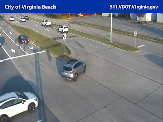
US-58 / Laskin Rd and N Birdneck Rd
1

US-58 / Laskin Rd and N Birdneck Rd

Virginia Beach, VA

VDOT 511
US-58 and N Great Neck Rd
2

US-58 and N Great Neck Rd

Virginia Beach, VA

VDOT 511
US-58 and Lynnhaven Pkwy
3

US-58 and Lynnhaven Pkwy

Virginia Beach, VA
VDOT 511
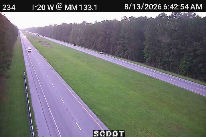
I-20
9 cameras
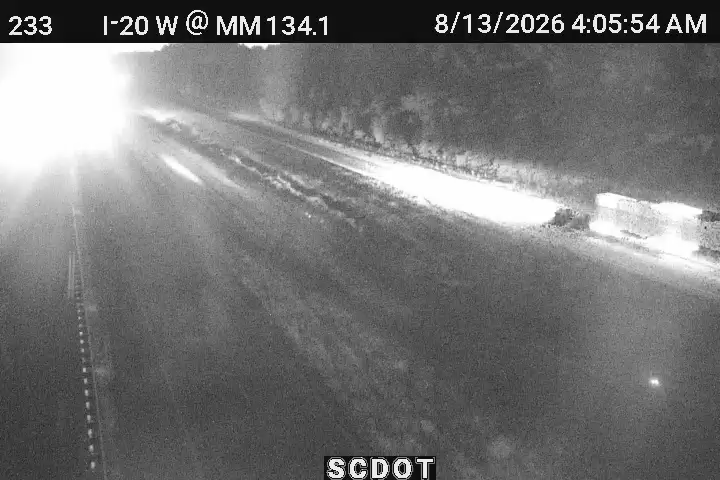
50233
4

50233

Florence, SC ·

50234
5

50234

Florence, SC ·

50235
6

50235

Florence, SC ·

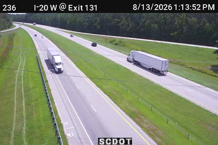
50236
7

50236

Florence, SC ·

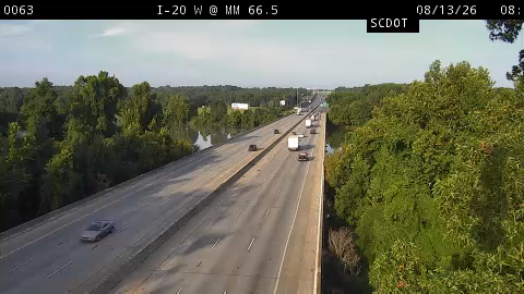
10063
8

10063

Columbia, SC ·

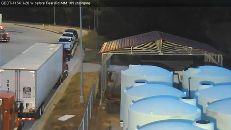
GDOT-1154: I-20 W before FearsRd MM 108.2 (Morgan)
9

GDOT-1154: I-20 W before FearsRd MM 108.2 (Morgan)

GA · WB
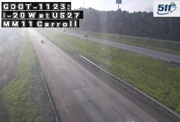
GDOT-1123: I-20 W at US27 MM 11.1 (Carroll)
10

GDOT-1123: I-20 W at US27 MM 11.1 (Carroll)

GA · WB
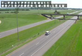
I-20 at Pecanland Mall
11

I-20 at Pecanland Mall

LA ·

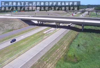
I-20 at I-220 Off Ramp
12

I-20 at I-220 Off Ramp

LA ·

Rest Stops Along Your Route

190 stops available

Swipe to see more

Rest Area

Near start

Open
Restrooms

Rest Area

Near start

Open
Restrooms
Fuel
Food

Rest Area

Near start

Open
Restrooms
Fuel
Food

Love's Travel Stop

Near start

Open
Restrooms
Fuel
Food

Pilot Travel Center

6% along route

Open
Restrooms
Fuel
Food

Love's Travel Stop

317 • 6% along route

Open
Restrooms
Fuel
Food

Virginia Welcome Center

7% along route

Open
Restrooms

Rest Area

7% along route

Open
Restrooms

Rest Area

7% along route

Open
Restrooms

North Carolina Welcome Center

7% along route

Open
Restrooms

ONE9 Travel Center

58 • 7% along route

Open
Restrooms
Fuel
Food
WiFi

Southbound Nash County Rest Area

SB • 9% along route

Open
Restrooms

Northbound Nash County Rest Area

NB • 9% along route

Open
Restrooms

Petro Stopping Centers

0395 • 11% along route

Open
Restrooms
Fuel
Food

Pilot Travel Center

11% along route

Open
Restrooms
Fuel
Food

Flying J Travel Center

11% along route

Open
Restrooms
Fuel
Food

I-95 Southbound ─ Johnston County

SB • 12% along route

Open
Restrooms

Rest Area

13% along route

Open
Restrooms

Rest Area

13% along route

Open
Restrooms

Love's Travel Stop

412 • 13% along route

Open
Restrooms
Fuel
Food

Pilot Travel Center

14% along route

Open
Restrooms
Fuel
Food

Cumberland County I-95 Southbound Rest Area

SB • 15% along route

Open
Restrooms

North Carolina Welcome Center

17% along route

Open
Restrooms

Rest Area

18% along route

Open
Restrooms

Rest Area

18% along route

Open
Restrooms
Fuel
Food

Love's Travel Stop

371 • 18% along route

Open
Restrooms
Fuel
Food

Pilot Travel Center

19% along route

Open
Restrooms
Fuel
Food

Flying J Travel Center

19% along route

Open
Restrooms
Fuel
Food

Buc-ee's

19% along route

Open
Restrooms
Fuel
Food

Pilot Travel Center

19% along route

Open
Restrooms
Fuel
Food

Petro Stopping Centers

0393 • 20% along route

Open
Restrooms
Fuel
Food

Pilot Travel Center

20% along route

Open
Restrooms
Fuel
Food

TA

0195 • 20% along route

Open
Restrooms
Fuel
Food

Pilot Travel Center

22% along route

Open
Restrooms
Fuel
Food

Rest Area

23% along route

Open
Restrooms

Rest Area

23% along route

Open
Restrooms

Pilot Travel Center

23% along route

Open
Restrooms
Fuel
Food

Love's Travel Stop

24% along route

Open
Restrooms
Fuel
Food

TA

0262 • 25% along route

Open
Restrooms
Fuel
Food

Flying J Travel Center

25% along route

Open
Restrooms
Fuel
Food

QuikTrip

1198 • 26% along route

Open
Restrooms
Fuel
Food

Love's Travel Stop

26% along route

Open
Restrooms
Fuel
Food

Truck Stop 44

26% along route

Open
Restrooms
Fuel
Food

Rest Area

27% along route

Open
Restrooms
Fuel
Food

Rest Area

27% along route

Open
Restrooms
Fuel
Food

Pilot Travel Center

29% along route

Open
Restrooms
Fuel
Food

Rest Area

29% along route

Open
Restrooms
Fuel
Food

Rest Area

29% along route

Open
Restrooms
Fuel
Food

Rest Area

29% along route

Open
Restrooms
Fuel
Food

Rest Area

29% along route

Open
Restrooms

Rest Area

29% along route

Open
Restrooms

Pilot Travel Center

29% along route

Open
Restrooms
Fuel
Food

Rest Area

30% along route

Open
Restrooms

Rest Area

30% along route

Open
Restrooms

Rest Area

31% along route

Open
Restrooms

Rest Area

31% along route

Open
Restrooms

Love's Travel Stop

354 • 31% along route

Open
Restrooms
Fuel
Food

WD Price Service Station

33% along route

Open
Restrooms

Flying J Travel Center

34% along route

Open
Restrooms
Fuel
Food

TA

0045 • 35% along route

Open
Restrooms
Fuel
Food

Pilot Travel Center

35% along route

Open
Restrooms
Fuel
Food

Love's Travel Stop

35% along route

Open
Restrooms
Fuel
Food

Rest Area

36% along route

Open
Restrooms

Rest Area

36% along route

Open
Restrooms

Rest Area

36% along route

Open
Restrooms

Pilot Travel Center

38% along route

Open
Restrooms
Fuel
Food

Petro Stopping Centers

0322 • 39% along route

Open
Restrooms
Fuel
Food
WiFi

Rest Area

39% along route

Open
Restrooms

QuikTrip

777 • 40% along route

Open
Restrooms
Fuel
Food

Rest Area

40% along route

Open
Restrooms
Fuel
Food

Rest Area

40% along route

Open
Restrooms

Pilot Travel Center

41% along route

Open
Restrooms
Fuel
Food

Flying J Travel Center

41% along route

Open
Restrooms
Fuel
Food

Pilot Travel Center

41% along route

Open
Restrooms
Fuel
Food

Rest Area

42% along route

Open
Restrooms

Love's Travel Stop

311 • 42% along route

Open
Restrooms
Fuel
Food

Pilot Travel Center

42% along route

Open
Restrooms
Fuel
Food

Newborn TruckStop

42% along route

Open
Restrooms

Alabama Welcome Center

43% along route

Open
Restrooms

Rest Area

43% along route

Open
Restrooms

Love's Travel Stop

43% along route

Open
Restrooms
Fuel
Food

Pilot Travel Center

46% along route

Open
Restrooms
Fuel
Food

TA

0260 • 46% along route

Open
Restrooms
Fuel
Food

Pilot Travel Center

46% along route

Open
Restrooms
Fuel
Food

Rest Area

46% along route

Open
Restrooms
Fuel
Food

Love's Travel Stop

530 • 47% along route

Open
Restrooms
Fuel
Food

Buc-ee's

43 • 48% along route

Open
Restrooms
Fuel
Food

Flying J Travel Center

50% along route

Open
Restrooms
Fuel
Food

Petro Stopping Centers

0319 • 50% along route

Open
Restrooms
Fuel
Food

Petro Stopping Centers

50% along route

Open
Restrooms
Fuel
Food

Rest Area

50% along route

Open
Restrooms
Fuel
Food

Love's Travel Stop

227 • 50% along route

Open
Restrooms
Fuel
Food

Tuscaloosa County Rest Area (Southbound)

SB • 51% along route

Open
Basic facilities

Tuscaloosa County Rest Area - I 59 Northbound

NB • 51% along route

Open
Basic facilities

ONE9 Travel Center

51% along route

Open
Restrooms
Fuel
Food

TA

0016 • 51% along route

Open
Restrooms
Fuel
Food

QuikTrip

7170 • 51% along route

Open
Restrooms
Fuel
Food

Pilot Travel Center

51% along route

Open
Restrooms
Fuel
Food

Love's Travel Stop

54% along route

Open
Restrooms
Fuel
Food

Greene County Rest Area - I 59 Southbound

SB • 54% along route

Open
Restrooms

Greene County Rest Area - I 59 Northbound

NB • 54% along route

Open
Restrooms

Sumter Welcome Center

56% along route

Open
Restrooms
Picnic
WiFi

Love's Travel Stop

343 • 57% along route

Open
Restrooms
Fuel
Food

Lauderdale County Welcome Center

57% along route

Open
Restrooms

Rest Area

57% along route

Open
Restrooms

TA

0047 • 57% along route

Open
Restrooms
Fuel
Food

Pilot Travel Center

388 • 57% along route

Open
Restrooms
Fuel
Food
WiFi

Rest Area

58% along route

Open
Restrooms

Mr. Fuel Travel Center

58% along route

Open
Restrooms
Fuel
Food

Rest Area

59% along route

Open
Restrooms

Love's Travel Stop

60% along route

Open
Restrooms
Fuel
Food

Scott County Rest Area

60% along route

Open
Restrooms

Love's Travel Stop

420 • 63% along route

Open
Restrooms
Fuel
Food

Flying J Travel Center

63% along route

Open
Restrooms
Fuel
Food

Pilot Travel Center

63% along route

Open
Restrooms
Fuel
Food

Petro Stopping Centers

0328 • 63% along route

Open
Restrooms
Fuel
Food

Love's Travel Stop

65% along route

Open
Restrooms
Fuel
Food

Louisiana Tourism Welcome Center

66% along route

Open
Restrooms

Love's Travel Stop

237 • 67% along route

Open
Restrooms
Fuel
Food

TA

0046 • 67% along route

Open
Restrooms
Fuel
Food

Pilot Travel Center

70% along route

Open
Restrooms
Fuel
Food

Love's Travel Stop

806 • 71% along route

Open
Restrooms
Fuel
Food
WiFi

Pilot Travel Center

71% along route

Open
Restrooms
Fuel
Food

USA Truck Stop

72% along route

Open
Restrooms
Fuel
Food

Rest Area

72% along route

Open
Restrooms

Rest Area

72% along route

Open
Restrooms

Rest Area

72% along route

Open
Restrooms

Rest Area

72% along route

Open
Restrooms

TA

0946 • 75% along route

Open
Restrooms
Fuel
Food

Quick Draw Travel Plaza

76% along route

Open
Restrooms
Fuel
Food

Wallys Fast Food

76% along route

Open
Restrooms

Love's Travel Stop

76% along route

Open
Restrooms
Fuel
Food

Rest Area

76% along route

Open
Restrooms

Rest Area

76% along route

Open
Restrooms

Pilot Travel Center

77% along route

Open
Restrooms
Fuel
Food

QuikTrip

7223 • 77% along route

Open
Restrooms
Fuel
Food

QuikTrip

7220 • 78% along route

Open
Restrooms
Fuel
Food

Petro Stopping Centers

0308 • 78% along route

Open
Restrooms
Fuel
Food

TA

0237 • 78% along route

Open
Restrooms
Fuel
Food

Flying J Travel Center

78% along route

Open
Restrooms
Fuel
Food

Love's Travel Stop

78% along route

Open
Restrooms
Fuel
Food

Rest Area

79% along route

Open
Restrooms

Texas Travel Information Center at Waskom

79% along route

Open
WiFi
Restrooms open 24/7, Visitor Center open Mo-Su 08:00-17:00 Directions

Picnic Area

80% along route

Open
Picnic

TA Express

0281 • 82% along route

Open
Restrooms
Fuel
Food

Love's Travel Stop

83% along route

Open
Restrooms
Fuel
Food

Winona Westbound Picnic Area

WB • 83% along route

Open
Picnic

Rest Area

83% along route

Open
Restrooms
Fuel
Food

Texas Best Smokehouse Travel Plaza

83% along route

Open
Restrooms
Fuel
Food

Pilot Travel Center

84% along route

Open
Restrooms
Fuel
Food
WiFi

QuikTrip

7901 • 84% along route

Open
Restrooms
Fuel
Food

Love's Travel Stop

287 • 85% along route

Open
Restrooms
Fuel
Food

Love's Travel Stop

85% along route

Open
Restrooms
Fuel
Food

Van Zandt County Westbound Rest Area

WB • 85% along route

Open
Restrooms
Picnic

Rest Area

86% along route

Open
Restrooms
Fuel
Food

TA

0233 • 88% along route

Open
Restrooms
Fuel
Food

QuikTrip

993 • 88% along route

Open
Restrooms
Fuel
Food

Buc-ee's

36 • 88% along route

Open
Restrooms
Fuel
Food

Love's Travel Stop

331 • 89% along route

Open
Restrooms
Fuel
Food

QuikTrip

973 • 89% along route

Open
Restrooms
Fuel
Food

Rest Area

90% along route

Open
Restrooms
Fuel
Food

Flying J Travel Center

90% along route

Open
Restrooms
Fuel
Food

TA

0150 • 90% along route

Open
Restrooms
Fuel
Food

Rest Area

90% along route

Open
Restrooms
Fuel
Food

Pilot Travel Center

90% along route

Open
Restrooms
Fuel
Food

Rest Area

90% along route

Open
Restrooms
Fuel
Food

QuikTrip

943 • 90% along route

Open
Restrooms
Fuel
Food

Love's Travel Stop

91% along route

Open
Restrooms
Fuel
Food

Petro Stopping Centers

0340 • 92% along route

Open
Restrooms
Fuel
Food

Hill County Southbound Rest Area

SB • 93% along route

Open
Restrooms
Picnic

Road Ranger

94% along route

Open
Restrooms
Fuel
Food

QuikTrip

7903 • 94% along route

Open
Restrooms
Fuel
Food

Flying J Travel Center

94% along route

Open
Restrooms
Fuel
Food

Pilot Travel Center

Near destination

Open
Restrooms
Fuel
Food

Ascent Travel Center

Near destination

Open
Restrooms
Fuel
Food

Love's Travel Stop

Near destination

Open
Restrooms
Fuel
Food

Buc-ee's

35 • Near destination

Open
Restrooms
Fuel
Food

Bell County Southbound Rest Area

SB • Near destination

Open
Restrooms
Picnic

Rest Area

Near destination

Open
Restrooms
Fuel
Food

Flying J Travel Plaza

Near destination

Open
Restrooms
Fuel
Food

Walburg Travel Center & Food Court

Near destination

Open
Restrooms
Fuel
Food

QuikTrip

4178 • Near destination

Open
Restrooms
Fuel
Food

Rest Area

Near destination

Open
Restrooms

Rest Area

Near destination

Open
Restrooms

Rest Area

Near destination

Open
Restrooms

Rest Area

Near destination

Open
Restrooms

Rest Area

Near destination

Open
Restrooms

Rest Area

Near destination

Open
Restrooms

Rest Area

Near destination

Open
Restrooms

Juany Cleaning Service

Near destination

Open
Restrooms
Mo-Fr 08:30-16:30 Directions
🔔

Get Weather Alerts for This Route

We'll notify you when conditions change before your trip. Never drive into a surprise storm again.

Recent Weather Events on This Route

Premium users received alerts for these conditions:

  • 🌧️
    Aug 11: Heavy rain expected near Birmingham - consider afternoon departure

Don't miss the next alert →

Driving from Virginia Beach, VA to Austin, TX covers 1728 miles in roughly 28h 58m of drive time, crossing state lines. We track 12 live traffic cameras, 190 rest areas, 1 reported incident and 2 active weather alerts along this corridor so you can plan around them. On a drive this length, weather can change dramatically between stops. Use the segment-by-segment forecast below to time your route.

7-Day Driving Outlook

Today

Aug 13

89° / 85°

No precip

Safe

Tomorrow

Aug 14

🌦️

89° / 79°

No precip

Caution

Sat

Aug 15

🌦️🌤️

84° / 79°

No precip

Caution

Sun

Aug 16

☁️☁️

86° / 79°

No precip

Safe

Mon

Aug 17

🌦️☀️

99° / 80°

No precip

Safe

Tue

Aug 18

🌦️🌤️

89° / 84°

No precip

Caution

Wed

Aug 19

🌦️

82° / 80°

No precip

Caution

🗓️ Weekend Outlook

Saturday

Good to Go

🌦️ Moderate rain showers at origin, 🌤️ Mainly clear at destination

Sunday

Good to Go

☁️ Overcast at origin, ☁️ Overcast at destination

Plan This Route

Get hour-by-hour weather forecasts, real-time traffic, and find the optimal departure time.

🚗 Live traffic included

See if current slowdowns affect your drive time

Open in Planner

Free • No sign-up required

Current Conditions

Virginia Beach, VA

☀️

86°F

Wind: 12 mph

Austin, TX

☀️

93°F

Wind: 13 mph

Weather data updated in real-time

Driving from Virginia Beach, VA to Austin, TX

Your journey from Virginia Beach to Austin spans nearly 1,729 miles of America's heartland, taking you through three distinct regions as you head southwest across the country. You'll primarily travel on Interstate 64 west from Virginia Beach toward the Shenandoah Valley, then transition to Interstate 81, which carries you through the Blue Ridge Mountains and into Tennessee. From there, you'll merge onto Interstate 40, the southern route that becomes your main artery as it cuts through North Carolina, Tennessee, Arkansas, and Oklahoma before you finally head south on Interstate 35 into Texas and your final destination in Austin.

The terrain transforms dramatically throughout this cross-country journey, beginning with the coastal flatlands of Virginia before climbing into the Appalachian Mountains around the Virginia-West Virginia border. As you traverse through the Shenandoah Valley and the mountain passes along I-81, you'll experience significant elevation changes with some challenging grades, particularly around the Tennessee-North Carolina border where the landscape becomes increasingly rugged and forested. Once you cross into Arkansas on I-40, the terrain flattens considerably as you enter the Mississippi River plains, and the landscape gradually becomes more open and agricultural as you approach Oklahoma and eventually the rolling hills and plateau country of Texas.

Along your route, you'll pass through or near several notable cities that offer excellent opportunities for breaks and exploration, including Knoxville, Tennessee; Memphis, Tennessee; and Oklahoma City. The landscape shifts from dense eastern forests to increasingly sparse vegetation, and by the time you reach central Texas and Austin, you'll notice the transition to Hill Country terrain with its distinctive limestone formations and sparse vegetation.

The best time to tackle this drive is during spring or fall when temperatures are moderate and road conditions are most predictable. Summer months bring intense heat and potential afternoon thunderstorms along the I-40 corridor, while winter can create hazardous conditions in the mountain sections of Tennessee and North Carolina. Plan for roughly thirty hours of driving time, which translates to two full days on the road with adequate rest stops and overnight accommodations.

The 1728-mile drive from Virginia Beach, Virginia to Austin, Texas takes approximately 28h 58m under normal conditions. Weather along this route can vary significantly, especially along coastal regions where fog and marine weather can impact visibility. Route Outlook helps you find the safest time to travel by showing you weather conditions at every point along your route, timed to when you'll actually be there.

Common Weather Hazards on This Route

  • Severe thunderstorms and flash flooding (spring and summer)
  • Hurricane and tropical storm impacts (June through November)

Seasonal Driving Considerations

Coastal weather on this route can shift quickly. Marine fog is common during morning hours, especially in spring and fall, reducing visibility to near zero. Hurricane season (June through November) can bring extended road closures and dangerous conditions. During fair weather, coastal routes offer scenic driving — but always verify conditions with live traffic cameras before heading out.

Best Time to Drive Virginia Beach to Austin

For long drives like this 1728-mile journey, planning is essential. Consider breaking the trip into segments if weather looks challenging. The best approach is to check conditions for multiple departure times using Route Outlook's optimizer, which considers weather at each point when you'll actually be there.

Driving Strategy

Covering 1728 miles from Virginia Beach to Austin is a full-day or multi-day drive that requires advance planning. Break the route into manageable segments, planning fuel and rest stops every 2-3 hours. Weather that looks fine at departure may deteriorate significantly at the midpoint. Consider booking overnight accommodation if the forecast shows deteriorating conditions in the latter half. Route Outlook's segment-level weather data helps you identify exactly where and when conditions will change.

Pro Tip

Use Route Outlook's departure optimizer to find the best time to leave. Our 4D trajectory engine considers weather at each point along your route at the exact time you'll be there — not just at your destination. It also integrates live data from traffic cameras, DOT 511 feeds, and road weather sensors.

Frequently Asked Questions

How long is the drive from Virginia Beach to Austin?

The drive is approximately 1728 miles and takes about 28h 58m under normal traffic and weather conditions. Severe weather can add significant time to your trip.

What's the best day to drive this route?

Based on current forecasts, Today (Aug 13) looks ideal. Clear conditions expected along the entire route

Is it safe to drive from Virginia Beach to Austin today?

Current conditions show medium risk along this route. Use caution and allow extra time. Reduce speed and increase following distance as conditions warrant.

Are there rest areas on the Virginia Beach to Austin route?

Yes, there are 190 rest areas along this route. Facilities include restrooms, parking, and in some cases picnic areas and vending machines. Rest stops are spaced throughout the drive, so you'll never be too far from a break.

Can I see live traffic cameras on this route?

Yes, Route Outlook shows 12 live traffic cameras along this route, sourced from state DOT feeds. You can check road visibility, traffic flow, and pavement conditions in real time before and during your drive.

What highways does this route use?

This route primarily uses US-58, I-20. Conditions can vary between highway segments, so check live camera feeds and road condition reports for each stretch before departing.

Are there any road closures on this route right now?

There is currently 1 active incident along this route that may affect your drive. Check the incident details above for specific locations and expected durations.

Don't Drive Blind Into Weather

Route Outlook shows you conditions at every point along your route—at the exact time you'll be there.

Open Planner