Detroit, MI → Key West, FL

1599 mi · 26h 48m (driving)

⚠️

Current Risk

Medium Risk

Heat Advisory in effect along your route

Better time to leave

Friday

Based on weather forecast

Add traffic to your estimate
☁️

Detroit

76°

☀️

37.9°

72°

☀️

33.4°

76°

🌤️

29.0°

76°

☁️

Key West

81°

GOING
Sat, Aug 15

Trip Briefing

4 segments · 1599 mi · 26h 49m

Weather

☀️ Clear sky

72°F, wind 2 mph

Rest Stops

61

Restrooms, Truck svc

Clear driving conditions expected

Rest stops in this segment:

  • Rest Area 🚻
  • Flying J Travel Center
  • Carleton Rest Area 826 🚻

Weather May Slow Traffic

Active weather advisory — expect slower travel

Loading map...

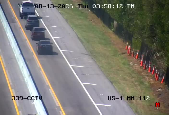
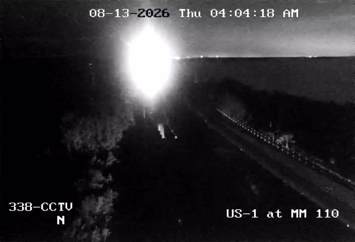
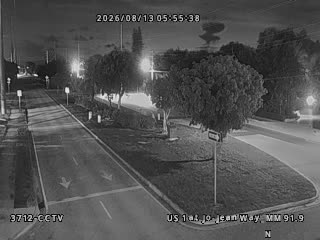
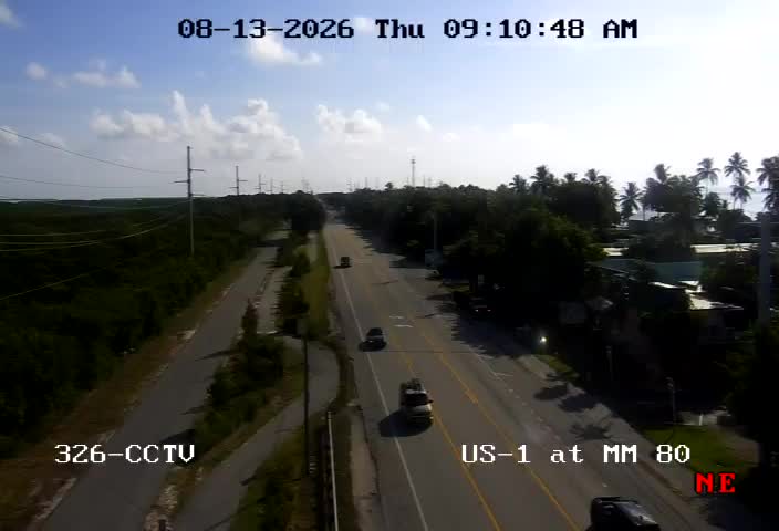
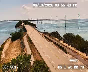
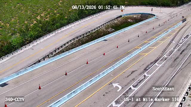
Traffic Cameras

See recent road conditions along your route

Images are snapshots updated periodically by state DOTs. Timestamps shown in images indicate when each photo was captured.

View all cameras

Choose your route:

Selected Route

Via I-75 South → I-640 West → ... → Florida's Turnpike Thru Lanes → US-1

M 10 NorthI-75 SouthI-640 WestI-40 WestI-75 South Metro Express Lanes +6 more

Cameras shown are along this computed route

Need a custom route?
US-1
6 cameras
US-1 at Mile Marker 116
1

US-1 at Mile Marker 116

FL · SB

US-1 at Mile Marker 112
2

US-1 at Mile Marker 112

FL · SB

US-1 at Mile Marker 110
3

US-1 at Mile Marker 110

FL · SB

US 1 at Jo-Jean Way
4

US 1 at Jo-Jean Way

FL · SB

US-1 at Mile Marker 80
5

US-1 at Mile Marker 80

FL · SB

US-1 at Mile Marker 79
6

US-1 at Mile Marker 79

FL · SB

Rest Stops Along Your Route

178 stops available

Swipe to see more

Rest Area

Near start

Open
Restrooms

Flying J Travel Center

Near start

Open
Restrooms
Fuel
Food

Carleton Rest Area 826

Near start

Open
Restrooms

Love's Travel Stop

Near start

Open
Restrooms
Fuel
Food

Pilot Travel Center

Near start

Open
Restrooms
Fuel
Food

TA

0069 • Near start

Open
Restrooms
Fuel
Food

Pilot Travel Center

Near start

Open
Restrooms
Fuel
Food

Monroe Welcome Center 823

Near start

Open
Restrooms

Pilot Travel Center

Near start

Open
Restrooms
Fuel
Food

Rest Area

Near start

Open
Restrooms

Wood Interstate 75 NB

NB • 6% along route

Open
Restrooms

Wood Interstate 75 SB

SB • 6% along route

Open
Restrooms

Petro Stopping Centers

0325 • 6% along route

Open
Restrooms
Fuel
Food

Love's Travel Stop

6% along route

Open
Restrooms
Fuel
Food

Rest Area

6% along route

Open
Restrooms

Rest Area

6% along route

Open
Restrooms

Rest Area

6% along route

Open
Restrooms

Rest Area

6% along route

Open
Restrooms

Pilot Travel Center

6% along route

Open
Restrooms
Fuel
Food

Rest Area

7% along route

Open
Restrooms
Fuel
Food

Rest Area

7% along route

Open
Restrooms
Fuel
Food

Rest Area

7% along route

Open
Restrooms

Rest Area

7% along route

Open
Restrooms

Rest Area

7% along route

Open
Restrooms

Rest Area

7% along route

Open
Restrooms

Hancock Interstate 75 SB

SB • 7% along route

Open
Restrooms

Rest Area

9% along route

Open
Restrooms
Fuel
Food

Pilot Travel Center

457 • 9% along route

Open
Restrooms
Fuel
Food

Flying J Travel Center

695 • 9% along route

Open
Restrooms
Fuel
Food

Rest Area

9% along route

Open
Restrooms

Rest Area

9% along route

Open
Restrooms

Rest Area

9% along route

Open
Restrooms

Auglaize Interstate 75 SB

SB • 10% along route

Open
Restrooms

Rest Area

10% along route

Open
Restrooms

Rest Area

10% along route

Open
Restrooms

City of Wapakoneta Public Works

10% along route

Open
Restrooms
Fuel
Food

TA

0082 • 10% along route

Open
Restrooms
Fuel
Food

Rest Area

11% along route

Open
Restrooms
Fuel
Food

Love's Travel Stop

11% along route

Open
Restrooms
Fuel
Food

Miami Interstate 75 SB

SB • 12% along route

Open
Restrooms

Miami Interstate 75 NB

NB • 12% along route

Open
Restrooms

Flying J Travel Center

97 • 13% along route

Open
Restrooms
Fuel
Food

Rest Area

13% along route

Open
Restrooms

Rest Area

14% along route

Open
Restrooms

Love's Travel Stop

14% along route

Open
Restrooms
Fuel
Food

Pilot Travel Center

15% along route

Open
Restrooms
Fuel
Food

Butler Interstate 75 Southbound

SB • 16% along route

Open
Restrooms

Rest Area

18% along route

Open
Restrooms

TA

18% along route

Open
Restrooms
Fuel
Food

Boone County (Florence) Welcome Center Southbound

SB • 18% along route

Open
Restrooms

Mr. Fuel Travel Center

18% along route

Open
Restrooms
Fuel
Food

Pilot Travel Center

18% along route

Open
Restrooms
Fuel
Food

TA

0028 • 18% along route

Open
Restrooms
Fuel
Food

Flying J Travel Center

18% along route

Open
Restrooms
Fuel
Food

Love's Travel Stop

618 • 21% along route

Open
Restrooms
Fuel
Food

Pilot Travel Center

21% along route

Open
Restrooms
Fuel
Food

Pilot Travel Center

21% along route

Open
Restrooms
Fuel
Food

Scott County (Georgetown) Rest Area Southbound

SB • 21% along route

Open
Restrooms

Love's Travel Stop

291 • 23% along route

Open
Restrooms
Fuel
Food

Buc-ee's

24% along route

Open
Restrooms
Fuel
Food

76 Fuel Center

25% along route

Open
Restrooms

London Truck Center

27% along route

Open
Restrooms
Fuel
Food

Truck scales and rest area - I75 SB

SB • 27% along route

Open
Restrooms
Fuel
Food

Love's Travel Stop

321 • 28% along route

Open
Restrooms
Fuel
Food

Pilot Travel Center

28% along route

Open
Restrooms
Fuel
Food

Pilot Travel Center

29% along route

Open
Restrooms
Fuel
Food

Tennessee Welcome Center

29% along route

Open
Restrooms

ONE9 Travel Center

32% along route

Open
Restrooms
Fuel
Food

Rest Area

33% along route

Open
Restrooms

Pilot Travel Center

33% along route

Open
Restrooms
Fuel
Food

TA

33% along route

Open
Restrooms
Fuel
Food

Love's Travel Stop

35% along route

Open
Restrooms
Fuel
Food

Pilot Travel Center

36% along route

Open
Restrooms
Fuel
Food
WiFi

McMinn County Rest Area Southbound

SB • 37% along route

Open
Restrooms

Rest Area

37% along route

Open
Restrooms

Love's Travel Stop

38% along route

Open
Restrooms
Fuel
Food

Pilot Travel Center

39% along route

Open
Restrooms
Fuel
Food

Rest Area

40% along route

Open
Restrooms
Fuel
Food

Rest Area

40% along route

Open
Restrooms
Fuel
Food

ONE9 Travel Center

41% along route

Open
Restrooms
Fuel
Food

Pilot Travel Center

41% along route

Open
Restrooms
Fuel
Food

Flying J Travel Center

42% along route

Open
Restrooms
Fuel
Food

Rest Area

42% along route

Open
Restrooms

Pilot Travel Center

42% along route

Open
Restrooms
Fuel
Food

Love's Travel Stop

42% along route

Open
Restrooms
Fuel
Food
WiFi

Buc-ee's

42% along route

Open
Restrooms
Fuel
Food

I-75 Rest Area

42% along route

Open
Restrooms

QuikTrip

757 • 42% along route

Open
Restrooms
Fuel
Food

Rest Area

43% along route

Open
Restrooms
Fuel
Food

TA

0146 • 43% along route

Open
Restrooms
Fuel
Food

Pilot Travel Center

43% along route

Open
Restrooms
Fuel
Food

Rest Area

43% along route

Open
Restrooms
Fuel
Food

Love's Travel Stop

44% along route

Open
Restrooms
Fuel
Food

Petro Stopping Centers

0322 • 46% along route

Open
Restrooms
Fuel
Food
WiFi

Pilot Travel Center

47% along route

Open
Restrooms
Fuel
Food

RaceTrac

47% along route

Open
Restrooms
Fuel
Food

Rest Area

47% along route

Open
Restrooms
Fuel
Food

QuikTrip

787 • 47% along route

Open
Restrooms
Fuel
Food

JP Travel Center

49% along route

Open
Restrooms
Fuel
Food

Flying J Travel Center

49% along route

Open
Restrooms
Fuel
Food

Pilot Travel Center

49% along route

Open
Restrooms
Fuel
Food

Love's Travel Stop

307 • 49% along route

Open
Restrooms
Fuel
Food

TA

0268 • 49% along route

Open
Restrooms
Fuel
Food

Monroe County Weigh Station - I-75 Southbound

SB • 50% along route

Open
Restrooms
Fuel
Food

QuikTrip

1730 • 50% along route

Open
Restrooms
Fuel
Food

Rest Area

SB • 51% along route

Open
Basic facilities

Circle K

52% along route

Open
Restrooms
Fuel
Food

Love's Travel Stop

698 • 52% along route

Open
Restrooms
Fuel
Food

QuikTrip

1722 • 52% along route

Open
Restrooms
Fuel
Food

Pilot Travel Center

52% along route

Open
Restrooms
Fuel
Food

Buc-ee's

52% along route

Open
Restrooms
Fuel
Food

All State Truck Stop

54% along route

Open
Restrooms
Fuel
Food

Rest Area

54% along route

Open
Basic facilities

Pinehurst Gas 'N Go Travel Center & Truck Wash

54% along route

Open
Restrooms
Fuel
Food

ONE9 Travel Center

55% along route

Open
Restrooms
Fuel
Food

Rest Area

55% along route

Open
Restrooms

Love's Travel Stop

55% along route

Open
Restrooms
Fuel
Food
WiFi

Pilot Travel Center

55% along route

Open
Restrooms
Fuel
Food

Rest Area

57% along route

Open
Restrooms

Pilot Travel Center

58% along route

Open
Restrooms
Fuel
Food
WiFi

Love's Travel Stop

58% along route

Open
Restrooms
Fuel
Food
WiFi

Rest Area

SB • 59% along route

Open
Restrooms
Mar 27-Aug 24 closed; Aug 25-Dec 31 open; Jan 01-Mar 26 open Directions

Adel Truck Plaza

59% along route

Open
Restrooms
Fuel
Food

I-75 Southbound Weigh Station

SB • 60% along route

Open
Restrooms
Fuel
Food

QuikTrip

7071 • 61% along route

Open
Restrooms
Fuel
Food

Rest Area

61% along route

Open
Restrooms
Fuel
Food

Bigfoot Traffic Center

61% along route

Open
Restrooms

Love's Travel Stop

550 • 61% along route

Open
Restrooms
Fuel
Food
WiFi

Love's Travel Stop

550 • 61% along route

Open
Restrooms
Fuel
Food
WiFi

Pilot Travel Center

61% along route

Open
Restrooms
Fuel
Food
WiFi

Georgia Visitor Information Center

62% along route

Open
Restrooms

TA

0249 • 62% along route

Open
Restrooms
Fuel
Food

Flying J Travel Center

62% along route

Open
Restrooms
Fuel
Food
WiFi

Joseph O. Striska Official Florida Welcome Center

20140 • 62% along route

Open
Restrooms

Pilot Travel Center

63% along route

Open
Restrooms
Fuel
Food

Pilot Travel Center

63% along route

Open
Restrooms
Fuel
Food

Busy Bee Truck Stop

64% along route

Open
Restrooms
Fuel
Food

Suwannee County Rest Area Eastbound

20111 • EB • 64% along route

Open
Restrooms

Love's Travel Stop

66% along route

Open
Restrooms
Fuel
Food

TA

0288 • 66% along route

Open
Restrooms
Fuel
Food

Columbia County Rest Area (I-75 southbound)

20162 • SB • 66% along route

Open
Restrooms

Alachua County Rest Area (I-75 southbound)

20172 • SB • 68% along route

Open
Restrooms

Petro Stopping Centers

0323 • 69% along route

Open
Restrooms
Fuel
Food

Love's Travel Stop

363 • 70% along route

Open
Restrooms
Fuel
Food

Pilot Travel Center

70% along route

Open
Restrooms
Fuel
Food

Pilot Travel Center

424 • 70% along route

Open
Restrooms
Fuel
Food

Marion County Rest Area Southbound

50182 • SB • 71% along route

Open
Restrooms

Rest Area

71% along route

Open
Restrooms

Pilot Travel Center

71% along route

Open
Restrooms
Fuel
Food

Wildwood I-75 Weigh Station Southbound

50662 • SB • 71% along route

Open
Restrooms

TA

0053 • 72% along route

Open
Restrooms
Fuel
Food

Pilot Travel Center

72% along route

Open
Restrooms
Fuel
Food

Pilot Travel Center

4556 • 72% along route

Open
Restrooms
Fuel
Food

Okahumpka Service Plaza

72% along route

Open
Restrooms

Turkey Lake Service Plaza

75% along route

Open
Restrooms

Rest Area

75% along route

Open
Restrooms

Rest Area

75% along route

Open
Restrooms

Rest Area

75% along route

Open
Restrooms

Rest Area

75% along route

Open
Restrooms

Canoe Creek Service Plaza

77% along route

Open
Restrooms

40392 Rest Area

40392 • 82% along route

Open
Restrooms

40391 Rest Area

40391 • 82% along route

Open
Restrooms

Flying J Travel Center

82% along route

Open
Restrooms
Fuel
Food

Love's Travel Stop

467 • 82% along route

Open
Restrooms
Fuel
Food

Pilot Travel Center

82% along route

Open
Restrooms
Fuel
Food

Love's Travel Stop

415 • 82% along route

Open
Restrooms
Fuel
Food

Port Saint Lucie - Fort Pierce Service Plaza

83% along route

Open
Restrooms

Port Saint Lucie - Fort Pierce Service Plaza

83% along route

Open
Restrooms

Rest Area

83% along route

Open
WiFi

40402 Rest Area

40402 • 83% along route

Open
Restrooms

40401 Rest Area

40401 • 83% along route

Open
Restrooms

Rest Area

86% along route

Open
Restrooms

West Palm Beach Service Plaza

86% along route

Open
Restrooms

Pompano Service Plaza

88% along route

Open
Restrooms

Snapper Creek Service Plaza

91% along route

Open
Restrooms

Rest Area

91% along route

Open
Restrooms

Rest Area

91% along route

Open
WiFi

Felton Road

Near destination

Open
Restrooms
🔔

Get Weather Alerts for This Route

We'll notify you when conditions change before your trip. Never drive into a surprise storm again.

Recent Weather Events on This Route

Premium users received alerts for these conditions:

  • 🌧️
    Aug 13: Rain advisory for afternoon departures
  • ❄️
    Aug 11: Snow expected at higher elevations - consider earlier departure
  • 🌫️
    Aug 8: Dense fog warning for morning travel

Don't miss the next alert →

Driving from Detroit, MI to Key West, FL covers 1599 miles in roughly 26h 48m of drive time, crossing state lines. We track 6 live traffic cameras, 178 rest areas and 2 active weather alerts along this corridor so you can plan around them. On a drive this length, weather can change dramatically between stops. Use the segment-by-segment forecast below to time your route.

7-Day Driving Outlook

Fri

Aug 14

🌫️🌧️

84° / 70°

7% precip

Caution

Today

Aug 15

☁️⛈️

85° / 65°

16% precip

Avoid

Tomorrow

Aug 16

⛈️☁️

83° / 72°

47% precip

Avoid

Mon

Aug 17

☁️☀️

83° / 65°

17% precip

Safe

Tue

Aug 18

🌧️☁️

85° / 65°

4% precip

Safe

Wed

Aug 19

🌧️☀️

82° / 67°

48% precip

Safe

Thu

Aug 20

☁️☁️

77° / 63°

36% precip

Safe

🗓️ Weekend Outlook

Saturday

Use Caution

⚠️ Hazardous conditions expected - Violent rain showers

Sunday

Use Caution

⚠️ Hazardous conditions expected - Thunderstorm

Plan This Route

Get hour-by-hour weather forecasts, real-time traffic, and find the optimal departure time.

🚗 Live traffic included

See if current slowdowns affect your drive time

Open in Planner

Free • No sign-up required

Current Conditions

Detroit, MI

☁️

76°F

Wind: 6 mph

Key West, FL

☁️

81°F

Wind: 8 mph

Weather data updated in real-time

Driving from Detroit, MI to Key West, FL

Your journey from Detroit to Key West is one of America's most dramatic road trips, taking you nearly 1,600 miles across the heartland and into tropical paradise. The route primarily follows I-75 South as your backbone, carrying you from Michigan through Ohio, Kentucky, Tennessee, Georgia, and Florida in a relatively straight shot toward the peninsula's tip. Once you reach central Florida, I-75 merges into Florida's Turnpike system, and eventually you'll transition onto US-41 and the scenic Overseas Highway (US-1), which strings together the Florida Keys with a series of bridges and causeways that feel more Caribbean than American.

The landscape transformations along this corridor are remarkable and worth noting as you drive. Your first twelve hours take you through the industrial Great Lakes region and Appalachian foothills, with modest elevation changes and numerous river crossings as you descend toward lower elevations. By the time you reach Atlanta and push deeper into Georgia and the Carolinas, the terrain flattens considerably, and the landscape shifts from urban sprawl to rolling pine forests and red clay farmland. The most dramatic visual shift comes when you enter South Florida—the landscape suddenly flattens entirely, and you'll notice the transition from hardwood forests to subtropical palmettos, saw grass marshes, and the distinctive Everglades ecosystem as you approach the Keys.

Notable cities break up your drive strategically: Cincinnati and Louisville offer comfortable stopping points in the upper sections, while Knoxville, Tennessee sits roughly halfway through. Further south, you'll pass through or near Orlando's bustling metropolis before heading toward the rural expanses of southern Florida. The final stretch along the Overseas Highway is unmissable, crossing the turquoise waters between the Keys with views that justify the entire drive.

Plan this drive during Florida's cooler months—October through April—when you'll avoid the summer heat and humidity that can make extended driving exhausting. Winter months offer the most pleasant conditions throughout the entire route, though spring can be equally rewarding. Traffic around Atlanta and the greater Tampa-Orlando corridor can slow your progress significantly, so consider traveling during off-peak hours if possible.

The 1599-mile drive from Detroit, Michigan to Key West, Florida takes approximately 26h 48m under normal conditions. Weather along this route can vary significantly, especially across open plains where severe weather and high winds can develop quickly. Route Outlook helps you find the safest time to travel by showing you weather conditions at every point along your route, timed to when you'll actually be there.

Common Weather Hazards on This Route

  • Winter storms and heavy snowfall (November through April)
  • Black ice on mountain passes and bridges
  • Severe thunderstorms and flash flooding (spring and summer)
  • Hurricane and tropical storm impacts (June through November)

Seasonal Driving Considerations

The Midwest corridor of this route is susceptible to rapid weather changes. Severe thunderstorms and tornadoes are a real threat from April through June, while winter brings heavy lake-effect snow, ice storms, and dangerously low wind chill. Flat terrain means high crosswinds can affect vehicle stability year-round, especially for taller vehicles. Spring flooding can also close highway underpasses and low-lying road segments.

Best Time to Drive Detroit to Key West

For long drives like this 1599-mile journey, planning is essential. Consider breaking the trip into segments if weather looks challenging. The best approach is to check conditions for multiple departure times using Route Outlook's optimizer, which considers weather at each point when you'll actually be there.

Driving Strategy

Covering 1599 miles from Detroit to Key West is a full-day or multi-day drive that requires advance planning. Break the route into manageable segments, planning fuel and rest stops every 2-3 hours. Weather that looks fine at departure may deteriorate significantly at the midpoint. Consider booking overnight accommodation if the forecast shows deteriorating conditions in the latter half. Route Outlook's segment-level weather data helps you identify exactly where and when conditions will change.

Pro Tip

Use Route Outlook's departure optimizer to find the best time to leave. Our 4D trajectory engine considers weather at each point along your route at the exact time you'll be there — not just at your destination. It also integrates live data from traffic cameras, DOT 511 feeds, and road weather sensors.

Frequently Asked Questions

How long is the drive from Detroit to Key West?

The drive is approximately 1599 miles and takes about 26h 48m under normal traffic and weather conditions. Severe weather can add significant time to your trip.

What's the best day to drive this route?

Based on current forecasts, Tuesday, Aug 18 looks ideal. Low chance of precipitation with manageable conditions

Is it safe to drive from Detroit to Key West today?

Current conditions show medium risk along this route. Conditions look favorable for travel. Always stay alert and adjust speed for changing conditions.

Are there rest areas on the Detroit to Key West route?

Yes, there are 178 rest areas along this route. Facilities include restrooms, parking, and in some cases picnic areas and vending machines. Rest stops are spaced throughout the drive, so you'll never be too far from a break.

Can I see live traffic cameras on this route?

Yes, Route Outlook shows 6 live traffic cameras along this route, sourced from state DOT feeds. You can check road visibility, traffic flow, and pavement conditions in real time before and during your drive.

What highways does this route use?

This route primarily uses US-1. Conditions can vary between highway segments, so check live camera feeds and road condition reports for each stretch before departing.

Are there any road closures on this route right now?

No significant incidents or road closures are currently reported along this route. Conditions can change quickly — this page updates automatically with the latest data from state DOT 511 systems.

Don't Drive Blind Into Weather

Route Outlook shows you conditions at every point along your route—at the exact time you'll be there.

Open Planner