
Long Beach, CA → North Las Vegas, NV
314 mi · 5h 16m (driving)
Current Risk
Medium Risk
High Surf Advisory in effect along your route
Long Beach
64°
Apple Valley
56°
San Bernardino County
68°
North Las Vegas
64°
Trip Briefing
3 segments · 314 mi · 5h 16m
Weather
☀️ Clear sky
56°F, wind 4 mph
Rest Stops
10
Restrooms, Truck svc
Cameras
5 live
Clear driving conditions expected
Rest stops in this segment:
- ● Rest Area 🚻
- ● Rest Area 🚻
- ● Rest Area 🚻
Weather May Slow Traffic
Active weather advisory — expect slower travel
Traffic Cameras
See recent road conditions along your route
Images are snapshots updated periodically by state DOTs. Timestamps shown in images indicate when each photo was captured.
Choose your route:
Selected Route
Via I-710 North → I-105 East → I-605 North → I-15 North
Cameras shown are along this computed route
Need a custom route?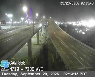
I-710 - I-710 : (955) Pico Ave - North
Long Beach, CA · NB
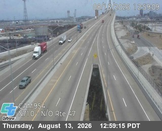
I-710 - I-710 : (954) North of SR-47 - North
Long Beach, CA · NB

I-605 - I-605 : (438) Valley Blvd - North
La Puente, CA · NB

I-210 - I-210 : (479) West of Monte Vista Ave - East
Claremont, CA · EB

I-15 - I-15 : (589) s/o Cleghorn Rd - North
Lytle Creek, CA · NB
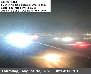
I-15 - I-15 : (604) Cement Co. OC - North
Victorville, CA · NB
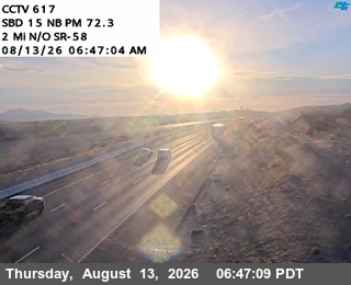
I-15 - I-15 : (617) N/O L St - North
Barstow, CA · NB
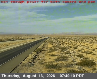
I-15 - I-15 : (630) s/o Field Rd. - North
Not Reported, CA · NB

I-15 - I-15 : (635) North Of Bird Ditch - Median
Not Reported, CA ·

I-15 - I-15 : (644) North Baker Blvd OC - North
Baker, CA · NB
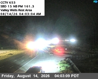
I-15 - I-15 : (653) ValleyWells RST - North
Mountain Pass, CA · NB

I-15 - I-15 : (663) Stateline - Median
Nipton, CA ·
Rest Stops Along Your Route
26 stops available
Swipe to see moreShowing 1-2 of 26

Get Weather Alerts for This Route
We'll notify you when conditions change before your trip. Never drive into a surprise storm again.
⚡ Recent Weather Events on This Route
Premium users received alerts for these conditions:
- 🌧️Sep 27: Rain advisory for afternoon departures
- ❄️Sep 25: Snow expected at higher elevations - consider earlier departure
- 🌫️Sep 22: Dense fog warning for morning travel
Don't miss the next alert →
Driving from Long Beach, CA to North Las Vegas, NV covers 314 miles in roughly 5h 16m of drive time, crossing state lines. We track 12 live traffic cameras, 26 rest areas and 2 active weather alerts along this corridor so you can plan around them. Most drivers do this trip in one day; weather along the route matters more than the forecast at either endpoint, since you'll cross several climate zones.
7-Day Driving Outlook
Today
Sep 29
84° / 64°
No precip
Tomorrow
Sep 30
80° / 68°
No precip
Thu
Oct 1
84° / 65°
No precip
Fri
Oct 2
86° / 66°
No precip
Sat
Oct 3
92° / 69°
No precip
Sun
Oct 4
94° / 75°
No precip
Mon
Oct 5
90° / 73°
No precip
🗓️ Weekend Outlook
Saturday
Good to Go☀️ Clear sky at origin, ⛅ Partly cloudy at destination
Sunday
Good to Go☀️ Clear sky at origin, ☀️ Clear sky at destination
Plan This Route
Get hour-by-hour weather forecasts, real-time traffic, and find the optimal departure time.
🚗 Live traffic included
See if current slowdowns affect your drive time
Free • No sign-up required
Current Conditions
Long Beach, CA
64°F
Wind: 4 mph
North Las Vegas, NV
64°F
Wind: 3 mph
Weather data updated in real-time
Driving from Long Beach, CA to North Las Vegas, NV
The journey from Long Beach to North Las Vegas is a straightforward desert crossing that covers approximately 314 miles in around five hours and sixteen minutes. You'll begin by heading east from Long Beach on Interstate 10, which quickly carries you through the greater Los Angeles metropolitan area before breaking free into the open landscape. As you progress east, you'll transition onto Interstate 15 near San Bernardino—this major north-south corridor becomes your primary route for the remainder of the drive, taking you all the way through the Mojave Desert and directly into Nevada.
As you leave the urban sprawl of Southern California behind, you'll notice dramatic elevation changes that define this route. The San Bernardino Mountains give way to the Mojave Desert plateau, where the landscape transforms into vast stretches of scrubland, Joshua trees, and distinctive desert rock formations. Around Victorville and through the high desert regions of California, you'll climb to elevations near 3,000 feet before descending again as you approach the Nevada border near Primm, Nevada. The terrain is remarkably open throughout this section, offering expansive views across the desert floor and distant mountain ranges on the horizon.
Victorville serves as a notable midpoint along your journey, providing opportunities for fuel, food, and a quick stretch break before the final desert push into Nevada. Beyond this town, the landscape becomes increasingly remote and rural, with relatively few services until you approach the Las Vegas Valley. You'll pass through the small community of Primm right at the California-Nevada border, where several casino resorts mark the beginning of the Las Vegas metropolitan area's sprawl northward into North Las Vegas.
For the most pleasant driving experience, plan this route during the cooler months between October and April, when desert temperatures are moderate and visibility is optimal. Summer months bring intense heat that can affect vehicle performance on the long, exposed stretches of I-15, while winter weather is generally mild in this region. The drive is relatively straightforward and well-maintained, making it manageable for most drivers, though the long, straight highway sections through the desert can feel monotonous—consider taking breaks in Victorville to stay alert and refreshed.
The 314-mile drive from Long Beach, California to North Las Vegas, Nevada takes approximately 5h 16m under normal conditions. Weather along this route can vary significantly, especially through mountainous terrain where elevation changes can bring sudden weather shifts. Route Outlook helps you find the safest time to travel by showing you weather conditions at every point along your route, timed to when you'll actually be there.
Common Weather Hazards on This Route
- Dense fog, especially during early morning hours
- Extreme heat and dust storms in desert regions
- Flash floods during monsoon season (July through September)
Seasonal Driving Considerations
Mountain passes along this corridor can be treacherous from October through May, with chain requirements, road closures, and whiteout conditions at higher elevations. Summer brings its own challenges — afternoon thunderstorms are common above 7,000 feet, and construction season narrows lanes on key highways. Always check pass conditions before departing, and carry emergency supplies during the colder months.
Best Time to Drive Long Beach to North Las Vegas
For medium-distance drives like this 314-mile route, consider starting in the early morning to arrive before afternoon storms develop. Check the 7-day forecast above to find a day with favorable conditions along the entire route.
Driving Strategy
A 314-mile drive from Long Beach to North Las Vegas takes a significant part of the day. Plan at least one fuel and rest stop along the way. If your route crosses elevation changes or state lines, expect weather conditions to shift mid-trip. Monitor the segment-by-segment forecast rather than just checking destination weather. Starting early in the morning typically avoids afternoon storm development and rush-hour congestion near urban areas.
Pro Tip
Use Route Outlook's departure optimizer to find the best time to leave. Our 4D trajectory engine considers weather at each point along your route at the exact time you'll be there — not just at your destination. It also integrates live data from traffic cameras, DOT 511 feeds, and road weather sensors.
Frequently Asked Questions
How long is the drive from Long Beach to North Las Vegas?
The drive is approximately 314 miles and takes about 5h 16m under normal traffic and weather conditions. Severe weather can add significant time to your trip.
What's the best day to drive this route?
Based on current forecasts, Saturday, Oct 3 looks ideal. Clear conditions expected along the entire route
Is it safe to drive from Long Beach to North Las Vegas today?
Current conditions show medium risk along this route. Conditions look favorable for travel. Always stay alert and adjust speed for changing conditions.
Are there rest areas on the Long Beach to North Las Vegas route?
Yes, there are 26 rest areas along this route. Facilities include restrooms, parking, and in some cases picnic areas and vending machines. Rest stops are spaced throughout the drive, so you'll never be too far from a break.
Can I see live traffic cameras on this route?
Yes, Route Outlook shows 12 live traffic cameras along this route, sourced from state DOT feeds. You can check road visibility, traffic flow, and pavement conditions in real time before and during your drive.
What highways does this route use?
This route primarily uses Other. Conditions can vary between highway segments, so check live camera feeds and road condition reports for each stretch before departing.
Are there any road closures on this route right now?
No significant incidents or road closures are currently reported along this route. Conditions can change quickly — this page updates automatically with the latest data from state DOT 511 systems.
Related Driving Guides
10 Essential Winter Driving Tips for Long Road Trips
Planning a winter road trip? Here are the essential safety tips to help you navigate snow, ice, and cold weather conditions.
🧊Black Ice: The Invisible Killer on Winter Roads
Black ice forms when rain or melting snow refreezes on cold road surfaces. Here's how to spot the conditions that create it.
🛡️Road Safety Features: Real-Time Conditions for Your Route
Real-time traffic incidents from 12 states, highway message signs, road conditions, and 25,000+ traffic cameras--integrated into your route planning.
Road Trip Guides Through This Area
California Wine Country: Napa and Sonoma
World-Class Wines in a Stunning Valley Setting
Route 66: Chicago to Santa Monica
The Mother Road — America's Most Famous Highway
Pacific Coast Highway: San Francisco to San Diego
One of America's Most Iconic Coastal Drives
Explore More Routes
More routes from Long Beach
More routes to North Las Vegas
Similar-distance drives
More routes starting in CA
Don't Drive Blind Into Weather
Route Outlook shows you conditions at every point along your route—at the exact time you'll be there.
Open Planner