
Portland, OR → Seattle, WA
190 mi · 3h 11m (driving)
Current Risk
Low Risk
Clear conditions along your route
Portland
53°
Cowlitz County
52°
Pierce County
58°
Seattle
58°
Trip Briefing
3 segments · 190 mi · 3h 11m
Weather
☁️ Overcast
52°F, wind 8 mph
Rest Stops
1
water, rvDump, Restrooms
Cameras
5 live
Clear driving conditions expected
Rest stops in this segment:
- ● Gee Creek Northbound Rest Area 🚻 🪑
Normal Traffic
4 construction zones along route — no other incidents
4 Construction Zones on Route
Road work on SR 7 both directions at milepost 52.52 ramp to east bound SR 512 beginning at 8:24 pm on September 28, 2026 until about 6:00 am on September 29, 2026. Ramp is fully blocked.
From 11:59 p.m. Monday, Sept. 28, to 4 am. Tuesday, Sept. 29, the northbound SR 167 off-ramp to southbound I-405 will close for crack sealing and pavement repair. Signed detours will be available.
The northbound I-405 off-ramp to Northeast 44th Street will be closed overnight from 9 p.m. – 5 a.m., starting the night of Monday, Sept. 28 to the morning of Tuesday, Sept. 29. A signed detour will be in place.
The express lanes are northbound-only 24 hours a day through the end of 2026 due to lane reductions for construction on the northbound I-5 Ship Canal Bridge.
Traffic Cameras
See recent road conditions along your route
Images are snapshots updated periodically by state DOTs. Timestamps shown in images indicate when each photo was captured.
Your Route
Via Southwest Naito Parkway → I-5 North
Cameras shown are along this computed route
Need a custom route?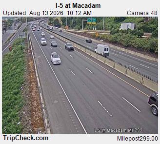
I-5 at Macadam
WA ·
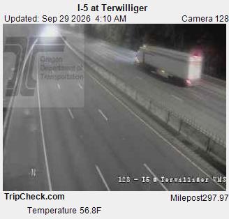
I-5 at Terwilliger
OR ·
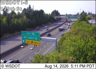
I-5 at MP 6.9: 129th St
WA ·
I-5 at MP 23.11: Dike Road
WA ·
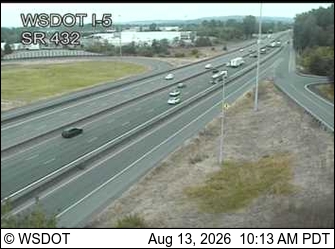
I-5 at MP 36.9: SR 432 Interchange
WA ·
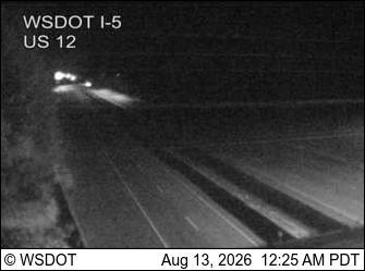
I-5 at MP 68.4: US 12 Interchange
WA ·
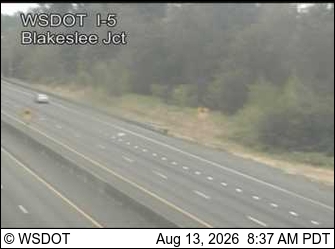
I-5 at MP 83.8: Blakeslee Junction
WA ·
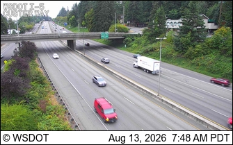
I-5 at MP 104: Custer Way
WA ·
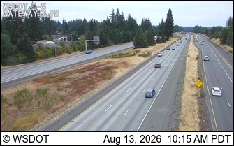
I-5 at MP 111.2: Gateway Blvd
WA ·

I-5 at MP 123.5: Murray Rd SW
WA · NB
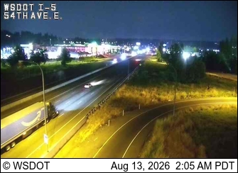
I-5 at MP 137.5: 54th at Fife
WA ·
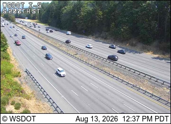
I-5 at MP 151.2: S 200th St
WA ·
Rest Stops Along Your Route
11 stops available
Swipe to see moreShowing 1-2 of 11

Get Weather Alerts for This Route
We'll notify you when conditions change before your trip. Never drive into a surprise storm again.
⚡ Recent Weather Events on This Route
Premium users received alerts for these conditions:
- 🌧️Sep 27: Rain advisory for afternoon departures
- ❄️Sep 25: Snow expected at higher elevations - consider earlier departure
- 🌫️Sep 22: Dense fog warning for morning travel
Don't miss the next alert →
Driving from Portland, OR to Seattle, WA covers 190 miles in roughly 3h 11m of drive time, crossing state lines. We track 12 live traffic cameras and 11 rest areas along this corridor so you can plan around them. A trip this short usually fits in a single morning or afternoon — check the live conditions just before you head out.
7-Day Driving Outlook
Today
Sep 29
70° / 52°
No precip
Tomorrow
Sep 30
70° / 58°
No precip
Thu
Oct 1
77° / 52°
No precip
Fri
Oct 2
76° / 57°
No precip
Sat
Oct 3
76° / 56°
No precip
Sun
Oct 4
80° / 57°
No precip
Mon
Oct 5
87° / 59°
No precip
🗓️ Weekend Outlook
Saturday
Good to Go⛅ Partly cloudy at origin, ☁️ Overcast at destination
Sunday
Good to Go⛅ Partly cloudy at origin, ⛅ Partly cloudy at destination
Plan This Route
Get hour-by-hour weather forecasts, real-time traffic, and find the optimal departure time.
🚗 Live traffic included
See if current slowdowns affect your drive time
Free • No sign-up required
Current Conditions
Portland, OR
53°F
Wind: 5 mph
Seattle, WA
58°F
Wind: 15 mph
Weather data updated in real-time
Driving from Portland, OR to Seattle, WA
The drive from Portland to Seattle is one of the Pacific Northwest's most straightforward and frequently traveled routes, taking you roughly 190 miles northward primarily via Interstate 5. You'll depart Portland heading north on I-5, which serves as the backbone of this journey, carrying you through the Willamette Valley before transitioning into the broader Columbia River Gorge region as you approach the Washington state line. The interstate is generally well-maintained and heavily trafficked, particularly through the Portland metropolitan area and again as you approach Seattle, so you can expect moderate to heavy traffic during peak hours. This route is remarkably efficient for covering distance, and the relatively straight path means you'll spend most of your three hours and eleven minutes on the same major corridor rather than navigating complex back roads.
As you progress northward, you'll experience subtle but noticeable landscape transitions that define the Pacific Northwest. Leaving Portland's urban envelope, the terrain opens into the agricultural flatlands of the Willamette Valley, where you'll see berry farms and nurseries dotting the countryside. Around Salem and further north, the landscape gradually transitions from agricultural zones into more forested terrain as you move toward the volcanic plateau regions. The terrain itself remains relatively modest in elevation change despite the region's proximity to the Cascade Mountains, which rise majestically to your east, though the mountains themselves remain largely out of direct view from I-5.
You'll pass through or near several significant communities that serve as practical waypoints, including Salem, Corvallis (visible to the west), and the larger metropolitan area of Olympia, Washington's capital, which marks the southern edge of the Seattle metro region. These towns offer opportunities to stretch your legs, grab fuel, or enjoy a quick meal without significantly delaying your arrival. Spring and fall represent the ideal seasons for this drive, offering dry conditions and clear visibility without the summer heat or winter precipitation that can occasionally impact I-5. Winter months can bring occasional ice or heavy rain that temporarily slows traffic, while summer driving is generally pleasant, though the corridor can feel congested with vacation traffic on weekends.
The 190-mile drive from Portland, Oregon to Seattle, Washington takes approximately 3h 11m under normal conditions. Weather along this route can vary significantly, especially through mountainous terrain where elevation changes can bring sudden weather shifts. Route Outlook helps you find the safest time to travel by showing you weather conditions at every point along your route, timed to when you'll actually be there.
Common Weather Hazards on This Route
- Dense fog, especially during early morning hours
Seasonal Driving Considerations
Mountain passes along this corridor can be treacherous from October through May, with chain requirements, road closures, and whiteout conditions at higher elevations. Summer brings its own challenges — afternoon thunderstorms are common above 7,000 feet, and construction season narrows lanes on key highways. Always check pass conditions before departing, and carry emergency supplies during the colder months.
Best Time to Drive Portland to Seattle
For shorter trips like this 190-mile drive, morning departures typically offer the best conditions with lighter traffic and better visibility. Avoid rush hour periods (7-9 AM and 4-7 PM) if possible.
Driving Strategy
At 190 miles, the Portland to Seattle drive is short enough to complete in a single stretch. Still, check conditions along the route before you leave — a quick glance at live traffic cameras can confirm road visibility and surface conditions. If bad weather is forecasted for a narrow window, adjusting your departure by even an hour can make a significant difference in safety.
Pro Tip
Use Route Outlook's departure optimizer to find the best time to leave. Our 4D trajectory engine considers weather at each point along your route at the exact time you'll be there — not just at your destination. It also integrates live data from traffic cameras, DOT 511 feeds, and road weather sensors.
Frequently Asked Questions
How long is the drive from Portland to Seattle?
The drive is approximately 190 miles and takes about 3h 11m under normal traffic and weather conditions. Severe weather can add significant time to your trip.
What's the best day to drive this route?
Based on current forecasts, Sunday, Oct 4 looks ideal. Clear conditions expected along the entire route
Is it safe to drive from Portland to Seattle today?
Current conditions show low risk along this route. Conditions look favorable for travel. Always stay alert and adjust speed for changing conditions.
Are there rest areas on the Portland to Seattle route?
Yes, there are 11 rest areas along this route. Facilities include restrooms, parking, and in some cases picnic areas and vending machines. Rest stops are spaced throughout the drive, so you'll never be too far from a break.
Can I see live traffic cameras on this route?
Yes, Route Outlook shows 12 live traffic cameras along this route, sourced from state DOT feeds. You can check road visibility, traffic flow, and pavement conditions in real time before and during your drive.
What highways does this route use?
This route primarily uses Other. Conditions can vary between highway segments, so check live camera feeds and road condition reports for each stretch before departing.
Are there any road closures on this route right now?
No significant incidents or road closures are currently reported along this route. Conditions can change quickly — this page updates automatically with the latest data from state DOT 511 systems.
Related Driving Guides
10 Essential Winter Driving Tips for Long Road Trips
Planning a winter road trip? Here are the essential safety tips to help you navigate snow, ice, and cold weather conditions.
🧊Black Ice: The Invisible Killer on Winter Roads
Black ice forms when rain or melting snow refreezes on cold road surfaces. Here's how to spot the conditions that create it.
🛡️Road Safety Features: Real-Time Conditions for Your Route
Real-time traffic incidents from 12 states, highway message signs, road conditions, and 25,000+ traffic cameras--integrated into your route planning.
Explore More Routes
More routes from Portland
More routes to Seattle
Similar-distance drives
More routes starting in OR
Don't Drive Blind Into Weather
Route Outlook shows you conditions at every point along your route—at the exact time you'll be there.
Open Planner