
San Francisco, CA → Portland, OR
695 mi · 11h 38m (driving)
Current Risk
Low Risk
Clear conditions along your route
San Francisco
62°
39.7°
87°
41.6°
89°
43.6°
68°
Portland
69°
Trip Briefing
4 segments · 695 mi · 11h 39m
Weather
⛅ Partly cloudy
87°F, wind 10 mph
Rest Stops
8
Restrooms, water, Vending
Cameras
7 live
Clear driving conditions expected
Rest stops in this segment:
- ● Lucky Spot 🚻
- ● Hunter Hill Rest Area 🚻 🥤 🪑
- ● Pilot Travel Center
Normal Traffic
No traffic incidents reported
Traffic Cameras
See recent road conditions along your route
Images are snapshots updated periodically by state DOTs. Timestamps shown in images indicate when each photo was captured.
Choose your route:
Selected Route
Via I-80 East → I-505 North
Cameras shown are along this computed route
Need a custom route?
TV310 -- US-101: AT FAITH ST POC
San Francisco, CA · NB
TV310 -- US-101: AT FAITH ST POC
San Francisco, CA · NB
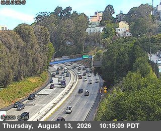
TV313 -- US-101 : At 23rd St
San Francisco, CA · NB
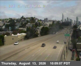
TV314 -- I-280 : At Indiana St
San Francisco, CA · NB
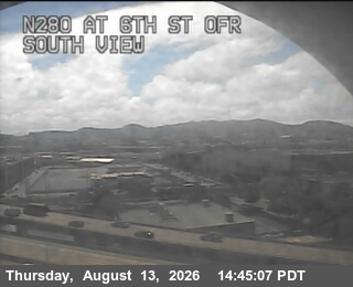
TV317 -- I-280 : 6th Street Offramp
San Francisco, CA · NB
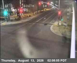
Hwy 128 at Main St (Winters)
Winters, CA
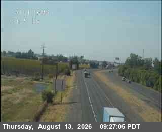
Hwy 5 at Williams NB
Williams, CA
Red Bluff
Red Bluff, CA
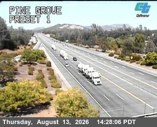
Pine Grove
Shasta Lake, CA
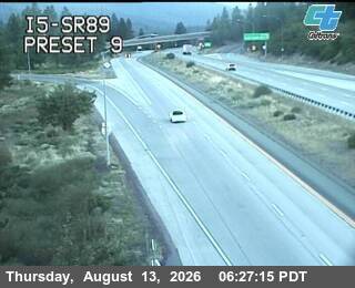
I5-SR89
Mount Shasta, CA
Hilt Sandhouse
Hornbrook, CA
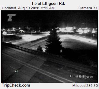
I-5 at Elligsen Road
WA ·
Rest Stops Along Your Route
54 stops available
Swipe to see moreShowing 1-2 of 54

Get Weather Alerts for This Route
We'll notify you when conditions change before your trip. Never drive into a surprise storm again.
⚡ Recent Weather Events on This Route
Premium users received alerts for these conditions:
- 🌧️Aug 14: Rain advisory for afternoon departures
- ❄️Aug 12: Snow expected at higher elevations - consider earlier departure
- 🌫️Aug 9: Dense fog warning for morning travel
Don't miss the next alert →
Driving from San Francisco, CA to Portland, OR covers 695 miles in roughly 11h 38m of drive time, crossing state lines. We track 12 live traffic cameras and 54 rest areas along this corridor so you can plan around them. On a drive this length, weather can change dramatically between stops. Use the segment-by-segment forecast below to time your route.
7-Day Driving Outlook
Sat
Aug 15
63° / 62°
No precip
Today
Aug 16
64° / 58°
No precip
Tomorrow
Aug 17
64° / 57°
No precip
Tue
Aug 18
62° / 58°
No precip
Wed
Aug 19
66° / 58°
No precip
Thu
Aug 20
69° / 58°
No precip
Fri
Aug 21
63° / 57°
No precip
🗓️ Weekend Outlook
Saturday
Good to Go⛅ Partly cloudy at origin, ⛅ Partly cloudy at destination
Sunday
Good to Go☁️ Overcast at origin, ⛅ Partly cloudy at destination
Plan This Route
Get hour-by-hour weather forecasts, real-time traffic, and find the optimal departure time.
🚗 Live traffic included
See if current slowdowns affect your drive time
Free • No sign-up required
Current Conditions
San Francisco, CA
62°F
Wind: 8 mph
Portland, OR
69°F
Wind: 4 mph
Weather data updated in real-time
Driving from San Francisco, CA to Portland, OR
You'll cover nearly 700 miles on this journey north, primarily following Interstate 5 through California and into Oregon, with some scenic variation possible along the way. The most direct route takes you out of San Francisco via US-101 North through the Bay Area, eventually merging onto I-5 near Stockton. From there, I-5 becomes your main artery, carrying you straight through California's Central Valley before crossing into Oregon near the town of Yreka. The drive typically takes just under twelve hours of actual driving time, though most travelers budget for a full day when accounting for stops and meals.
The landscape transforms dramatically as you head north, starting with the urban sprawl and coastal influence of the Bay Area before opening into the agricultural flatlands of California's Central Valley. As you progress toward Redding and beyond, the terrain becomes increasingly mountainous and forested, with the Cascade Range dominating views as you approach the Oregon border. You'll notice significant elevation changes, particularly as you climb through the Klamath Basin and enter Oregon's high country, where you might pass through areas above 4,000 feet, especially if you take detours toward Crater Lake. Salem and Eugene are the major population centers you'll encounter in Oregon, with Eugene marking a reasonable stopping point roughly two-thirds of the way through your journey.
This drive includes a mix of urban navigation, particularly exiting the San Francisco Bay Area and passing through Sacramento, balanced with long stretches of peaceful rural highway through forests and farmland. The Oregon portion of I-5 is notably more scenic than much of California's stretch, with the landscape becoming greener and more mountainous as you near Portland.
Spring through early fall offers the most pleasant driving conditions, with summer providing long daylight hours that make the journey feel less arduous. Winter can introduce hazardous conditions, particularly in Oregon's higher elevations where snow and ice occasionally close sections of I-5, so check conditions before departing during colder months.
The 695-mile drive from San Francisco, California to Portland, Oregon takes approximately 11h 38m under normal conditions. Weather along this route can vary significantly, especially through mountainous terrain where elevation changes can bring sudden weather shifts. Route Outlook helps you find the safest time to travel by showing you weather conditions at every point along your route, timed to when you'll actually be there.
Common Weather Hazards on This Route
- Dense fog, especially during early morning hours
- Extreme heat and dust storms in desert regions
- Flash floods during monsoon season (July through September)
Seasonal Driving Considerations
Mountain passes along this corridor can be treacherous from October through May, with chain requirements, road closures, and whiteout conditions at higher elevations. Summer brings its own challenges — afternoon thunderstorms are common above 7,000 feet, and construction season narrows lanes on key highways. Always check pass conditions before departing, and carry emergency supplies during the colder months.
Best Time to Drive San Francisco to Portland
For long drives like this 695-mile journey, planning is essential. Consider breaking the trip into segments if weather looks challenging. The best approach is to check conditions for multiple departure times using Route Outlook's optimizer, which considers weather at each point when you'll actually be there.
Driving Strategy
Covering 695 miles from San Francisco to Portland is a full-day or multi-day drive that requires advance planning. Break the route into manageable segments, planning fuel and rest stops every 2-3 hours. Weather that looks fine at departure may deteriorate significantly at the midpoint. Consider booking overnight accommodation if the forecast shows deteriorating conditions in the latter half. Route Outlook's segment-level weather data helps you identify exactly where and when conditions will change.
Pro Tip
Use Route Outlook's departure optimizer to find the best time to leave. Our 4D trajectory engine considers weather at each point along your route at the exact time you'll be there — not just at your destination. It also integrates live data from traffic cameras, DOT 511 feeds, and road weather sensors.
Frequently Asked Questions
How long is the drive from San Francisco to Portland?
The drive is approximately 695 miles and takes about 11h 38m under normal traffic and weather conditions. Severe weather can add significant time to your trip.
What's the best day to drive this route?
Based on current forecasts, Saturday, Aug 15 looks ideal. Clear conditions expected along the entire route
Is it safe to drive from San Francisco to Portland today?
Current conditions show low risk along this route. Conditions look favorable for travel. Always stay alert and adjust speed for changing conditions.
Are there rest areas on the San Francisco to Portland route?
Yes, there are 54 rest areas along this route. Facilities include restrooms, parking, and in some cases picnic areas and vending machines. Rest stops are spaced throughout the drive, so you'll never be too far from a break.
Can I see live traffic cameras on this route?
Yes, Route Outlook shows 12 live traffic cameras along this route, sourced from state DOT feeds. You can check road visibility, traffic flow, and pavement conditions in real time before and during your drive.
What highways does this route use?
This route primarily uses Other. Conditions can vary between highway segments, so check live camera feeds and road condition reports for each stretch before departing.
Are there any road closures on this route right now?
No significant incidents or road closures are currently reported along this route. Conditions can change quickly — this page updates automatically with the latest data from state DOT 511 systems.
Related Driving Guides
10 Essential Winter Driving Tips for Long Road Trips
Planning a winter road trip? Here are the essential safety tips to help you navigate snow, ice, and cold weather conditions.
🧊Black Ice: The Invisible Killer on Winter Roads
Black ice forms when rain or melting snow refreezes on cold road surfaces. Here's how to spot the conditions that create it.
🛡️Road Safety Features: Real-Time Conditions for Your Route
Real-time traffic incidents from 12 states, highway message signs, road conditions, and 25,000+ traffic cameras--integrated into your route planning.
Road Trip Guides Through This Area
California Wine Country: Napa and Sonoma
World-Class Wines in a Stunning Valley Setting
Route 66: Chicago to Santa Monica
The Mother Road — America's Most Famous Highway
Pacific Coast Highway: San Francisco to San Diego
One of America's Most Iconic Coastal Drives
Oregon Coast: Highway 101
363 Miles of Untamed Pacific Coastline
Explore More Routes
More routes from San Francisco
More routes to Portland
Similar-distance drives
More routes starting in CA
Don't Drive Blind Into Weather
Route Outlook shows you conditions at every point along your route—at the exact time you'll be there.
Open Planner