
San Ramon → Santa Clara, CA
28 mi · 34m (driving)
Current Risk
Medium Risk
Coastal Flood Advisory in effect along your route
San Ramon
61°
Santa Clara
57°
Trip Briefing
1 segment · 28 mi · 34 min
Weather
☀️ Clear sky
61°F, wind 4 mph
Rest Stops
1
Restrooms
Cameras
12 live
Clear driving conditions expected
Rest stops in this segment:
- ● Rest Area 🚻
Weather May Slow Traffic
Active weather advisory — expect slower travel
Traffic Cameras
See recent road conditions along your route
Images are snapshots updated periodically by state DOTs. Timestamps shown in images indicate when each photo was captured.
Choose your route:
Selected Route
Via I-680 South
Cameras shown are along this computed route
Need a custom route?
CA-680 - TVF08 -- I-680 : Just South Of Norris Canyon Road - South
San Ramon, CA · SB
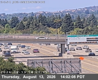
CA-680 - TVF10 -- I-680 : Just South Of Greenbrook Drive Overcross - South
Danville, CA · SB
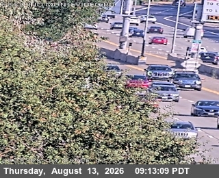
CA-680 - TVF06 -- I-680 : Just North Of Montevideo Road - South
San Ramon, CA · SB
CA-680 - TVF05 -- I-680 : South of Pine Valley Road UC - South
San Ramon, CA · SB
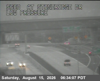
CA-680 - TVF01 -- I-680 : Stoneridge Drive - South
Pleasanton, CA · SB
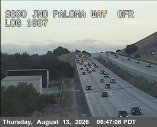
CA-680 - TVA13 -- I-680 : Paloma Way - South
Sunol, CA · SB
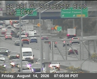
I-880 - TVB07 -- I-880 : Stevenson Boulevard - South
Newark, CA · SB
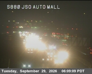
I-880 - TVC57 -- I-880 : AT JSO AUTOMALL - South
Fremont, CA · SB
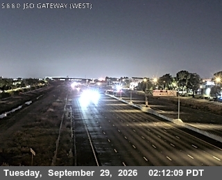
I-880 - TVB01 -- I-880 : AT JSO GATEWAY262 - South
Fremont, CA · SB
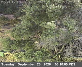
CA-680 - TVC35 -- I-680 : AT S680 at 237 - South
Milpitas, CA · SB
I-880 - TVC60 -- I-880 : US-101 - South
San Jose, CA · SB
I-880 - TVC54 -- I-880 : AT COLEMAN AV - South
San Jose, CA · SB
Rest Stops Along Your Route
1 stop available
Swipe to see moreShowing 1-1 of 1

Get Weather Alerts for This Route
We'll notify you when conditions change before your trip. Never drive into a surprise storm again.
⚡ Recent Weather Events on This Route
Premium users received alerts for these conditions:
- 🌧️Sep 27: Rain advisory for afternoon departures
- ❄️Sep 25: Snow expected at higher elevations - consider earlier departure
- 🌫️Sep 22: Dense fog warning for morning travel
Don't miss the next alert →
The drive from San Ramon to Santa Clara is about 28 miles and takes around 34m. We track 12 live traffic cameras, 1 rest area and 1 active weather alert along this corridor so you can plan around them. A trip this short usually fits in a single morning or afternoon — check the live conditions just before you head out.
7-Day Driving Outlook
Today
Sep 29
88° / 61°
No precip
Tomorrow
Sep 30
89° / 58°
No precip
Thu
Oct 1
91° / 56°
No precip
Fri
Oct 2
87° / 60°
No precip
Sat
Oct 3
90° / 66°
No precip
Sun
Oct 4
91° / 65°
No precip
Mon
Oct 5
89° / 62°
No precip
🗓️ Weekend Outlook
Saturday
Good to Go☁️ Overcast at origin, ☁️ Overcast at destination
Sunday
Good to Go☀️ Clear sky at origin, ☀️ Clear sky at destination
Plan This Route
Get hour-by-hour weather forecasts, real-time traffic, and find the optimal departure time.
🚗 Live traffic included
See if current slowdowns affect your drive time
Free • No sign-up required
Current Conditions
San Ramon
61°F
Wind: 4 mph
Santa Clara, CA
57°F
Wind: 4 mph
Weather data updated in real-time
Driving from San Ramon to Santa Clara, CA
The 28-mile drive from San Ramon to Santa Clara, California takes approximately 34m under normal conditions. Weather along this route can vary significantly, especially through mountainous terrain where elevation changes can bring sudden weather shifts. Route Outlook helps you find the safest time to travel by showing you weather conditions at every point along your route, timed to when you'll actually be there.
This short route connects San Ramon and Santa Clara. At under 100 miles, it's a manageable day trip, but weather conditions can still change between your origin and destination — especially across elevation changes or near large bodies of water.
Common Weather Hazards on This Route
- Dense fog, especially during early morning hours
- Extreme heat and dust storms in desert regions
- Flash floods during monsoon season (July through September)
Seasonal Driving Considerations
Weather along this route varies by season. Winter months can bring snow, ice, and reduced visibility, while summer may see thunderstorms, heat-related road issues, or construction zones. Spring and fall generally offer the most comfortable driving conditions but can still surprise with sudden weather changes. Regardless of season, checking real-time conditions along your entire route before departing can help you avoid the worst of it.
Best Time to Drive San Ramon to Santa Clara
For shorter trips like this 28-mile drive, morning departures typically offer the best conditions with lighter traffic and better visibility. Avoid rush hour periods (7-9 AM and 4-7 PM) if possible.
Driving Strategy
At 28 miles, the San Ramon to Santa Clara drive is short enough to complete in a single stretch. Still, check conditions along the route before you leave — a quick glance at live traffic cameras can confirm road visibility and surface conditions. If bad weather is forecasted for a narrow window, adjusting your departure by even an hour can make a significant difference in safety.
Pro Tip
Use Route Outlook's departure optimizer to find the best time to leave. Our 4D trajectory engine considers weather at each point along your route at the exact time you'll be there — not just at your destination. It also integrates live data from traffic cameras, DOT 511 feeds, and road weather sensors.
Frequently Asked Questions
How long is the drive from San Ramon to Santa Clara?
The drive is approximately 28 miles and takes about 34m under normal traffic and weather conditions. Severe weather can add significant time to your trip.
What's the best day to drive this route?
Based on current forecasts, Monday, Oct 5 looks ideal. Clear conditions expected along the entire route
Is it safe to drive from San Ramon to Santa Clara today?
Current conditions show medium risk along this route. Conditions look favorable for travel. Always stay alert and adjust speed for changing conditions.
Are there rest areas on the San Ramon to Santa Clara route?
Yes, there is 1 rest area along this route. Facilities include restrooms, parking, and in some cases picnic areas and vending machines. Rest stops are spaced throughout the drive, so you'll never be too far from a break.
Can I see live traffic cameras on this route?
Yes, Route Outlook shows 12 live traffic cameras along this route, sourced from state DOT feeds. You can check road visibility, traffic flow, and pavement conditions in real time before and during your drive.
What highways does this route use?
This route primarily uses Other. Conditions can vary between highway segments, so check live camera feeds and road condition reports for each stretch before departing.
Are there any road closures on this route right now?
No significant incidents or road closures are currently reported along this route. Conditions can change quickly — this page updates automatically with the latest data from state DOT 511 systems.
Related Driving Guides
Discover Hidden Road Trip Gems Near You
You don't need a week off to have an adventure. Discover weekend getaways and day trips within driving distance--personalized to your location.
📍A Practical Guide to Saving Routes and Monitoring Conditions
How to save frequent drives, track conditions on commutes and family trips, get alerts for bad weather, and find new routes from any city.
⏰Finding the Safest Time to Drive: A Data-Driven Approach
Learn how 4D trajectory analysis can help you find the optimal departure time to avoid dangerous weather and traffic.
Road Trip Guides Through This Area
California Wine Country: Napa and Sonoma
World-Class Wines in a Stunning Valley Setting
Route 66: Chicago to Santa Monica
The Mother Road — America's Most Famous Highway
Pacific Coast Highway: San Francisco to San Diego
One of America's Most Iconic Coastal Drives
Explore More Routes
Similar-distance drives
More routes starting in
Don't Drive Blind Into Weather
Route Outlook shows you conditions at every point along your route—at the exact time you'll be there.
Open Planner